2021-03-05
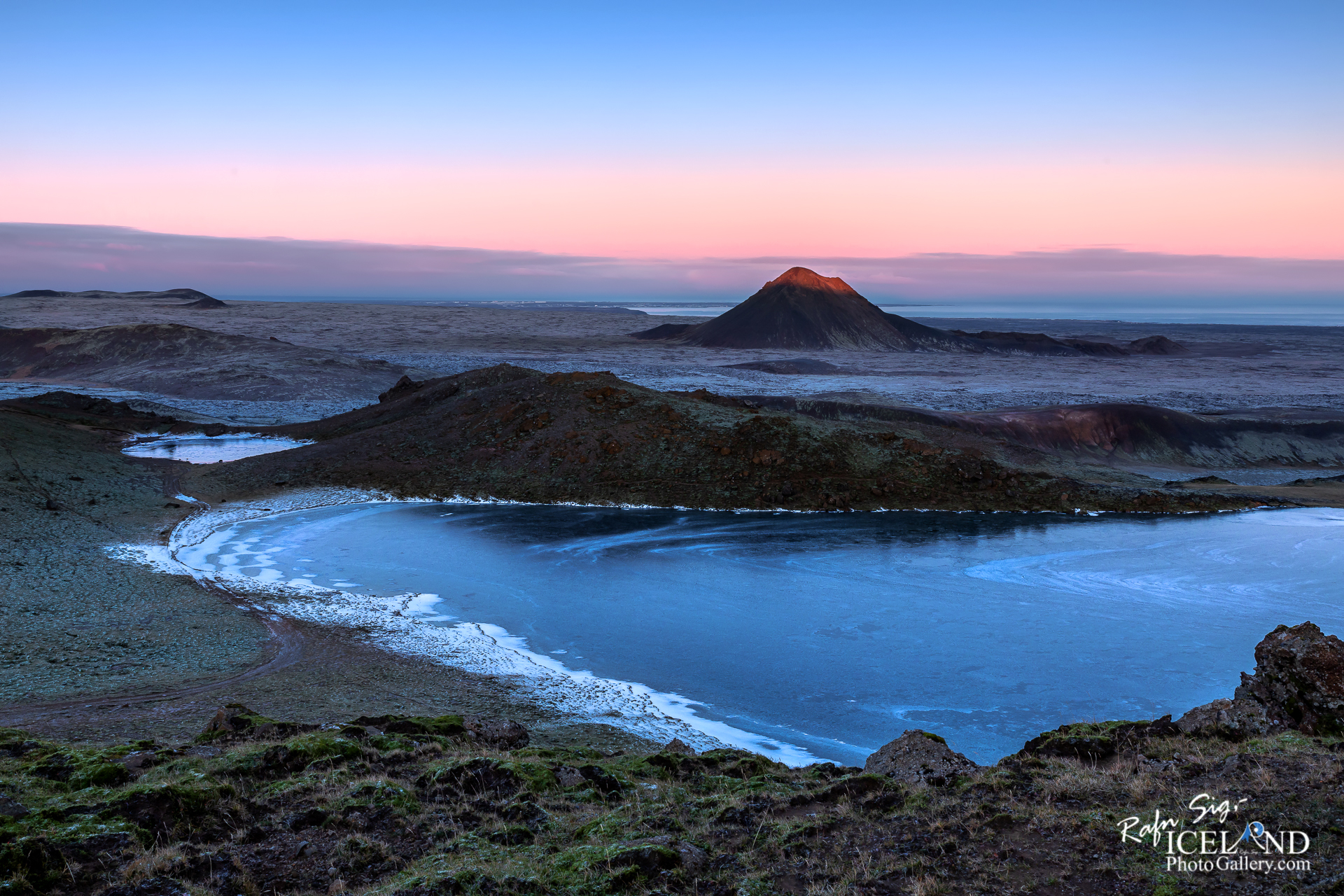
Keilir Volcano │ Iceland Landscape Photography
Documenting Iceland
by: Rafn Sig,-
English below:
Keilir er móbergsfjall á Reykjanesskaga. Fjallið hefur myndast á ísöld við gos undir jökli án þess að gosið næði upp úr jökulísnum. Hæð Keilis er um 379 metrar yfir sjó. Keilir er keilulaga og sést víða að. Hann er auðþekktur vegna lögunar sinnar. Sjómenn hafa löngum haft Keili sem mið og er hann til dæmis notaður þegar siglt er inn Hamarssund á leið inn til Sandgerðis. Af Keili er mikil og falleg útsýn og er auðveld ganga á fjallið að norðaustanverðu.
Þrátt fyrir að Keilir sé ekki virkt eldfjall má finna mikla eldvirkni allt í kringum fellið
– 0 –
The mountain Keilir was formed during the Ice Age, underneath a glacier and is classed as a hyaloclastite mountain, although scientists believe it to actually be the plug of a large crater. Hikers enjoy climbing the mountain as it’s not too high, but still poses enough of a challenge. Once you climb to the top, which takes around 2-3 hours, you are rewarded with a beautiful 360-degree view that simply takes your breath away.
Despite the fact that Keilir is not an . . . All info at: https://www.patreon.com/RafnSig
Subscribe to my Youtube Channel
You can buy this and other photos at my Icelandic Stock Photo Web: IcelandStockPhotos.com


0 Comments