
2021-07-13
Þjóðveldisbærinn Stöng │ Iceland Photo Gallery
Documenting Iceland
by: Rafn Sig,-
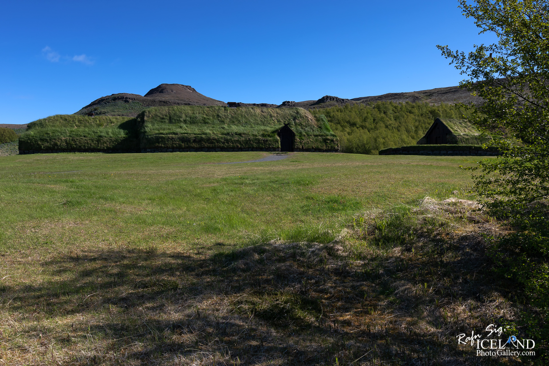
Þjóðveldisbærinn er bær neðan Sámsstaðamúla í Þjórsárdal á Íslandi reistur á árunum 1974–1977. Hann átti að sýna á sem raunverulegastan hátt hvernig stórbýli á söguöld litu út. Hörður Ágústsson teiknaði bæinn með hliðsjón af bæjarrústunum á Stöng í Þjórsárdal og rannsóknum sínum á íslenskri húsagerð á fyrri öldum.
Árið 2000 var komið fyrir við bæinn lítilli stafkirkju. Kirkjan er útkirkja frá Stóra-Núpi og þjónar sóknarpresturinn fyrir altari í þeim fáum messum sem haldnar eru þar.
Below the mountain of Sámsstaðamúli in Þjórsárdalur (Þjórsárdalur) in Southern Iceland lies the medieval farm, Þjóðveldisbærinn (Thjóthveldisbaerinn).
Þjóðveldisbærinn Stöng (Commonwealth Farm) is a reconstructed viking-era farmstead in Iceland, located in the Þjórsárdalur valley in Árnessýsla county. It is a historically accurate reconstruction of the three buildings, including a longhouse, which stood 7 km to the north at Stöng; the farm is believed to have been buried under volcanic ash in 1104 following the eruption of the volcano. . . All info at: https://www.patreon.com/RafnSig
Subscribe to my Youtube Channel
You can buy this and other photos at my Icelandic Stock Photo Web: IcelandStockPhotos.com
Liked it?
Take a second to support me on Patreon

As a native photographer I feel responsible to leave all I can behind to show how it looked like, with my photography, before it’s too late.


0 Comments