2021-01-04
Fimmvörðuháls Volcanic Eruptions – Iceland Landscape Photography
Documenting Iceland
by: Rafn Sig,-
English below.
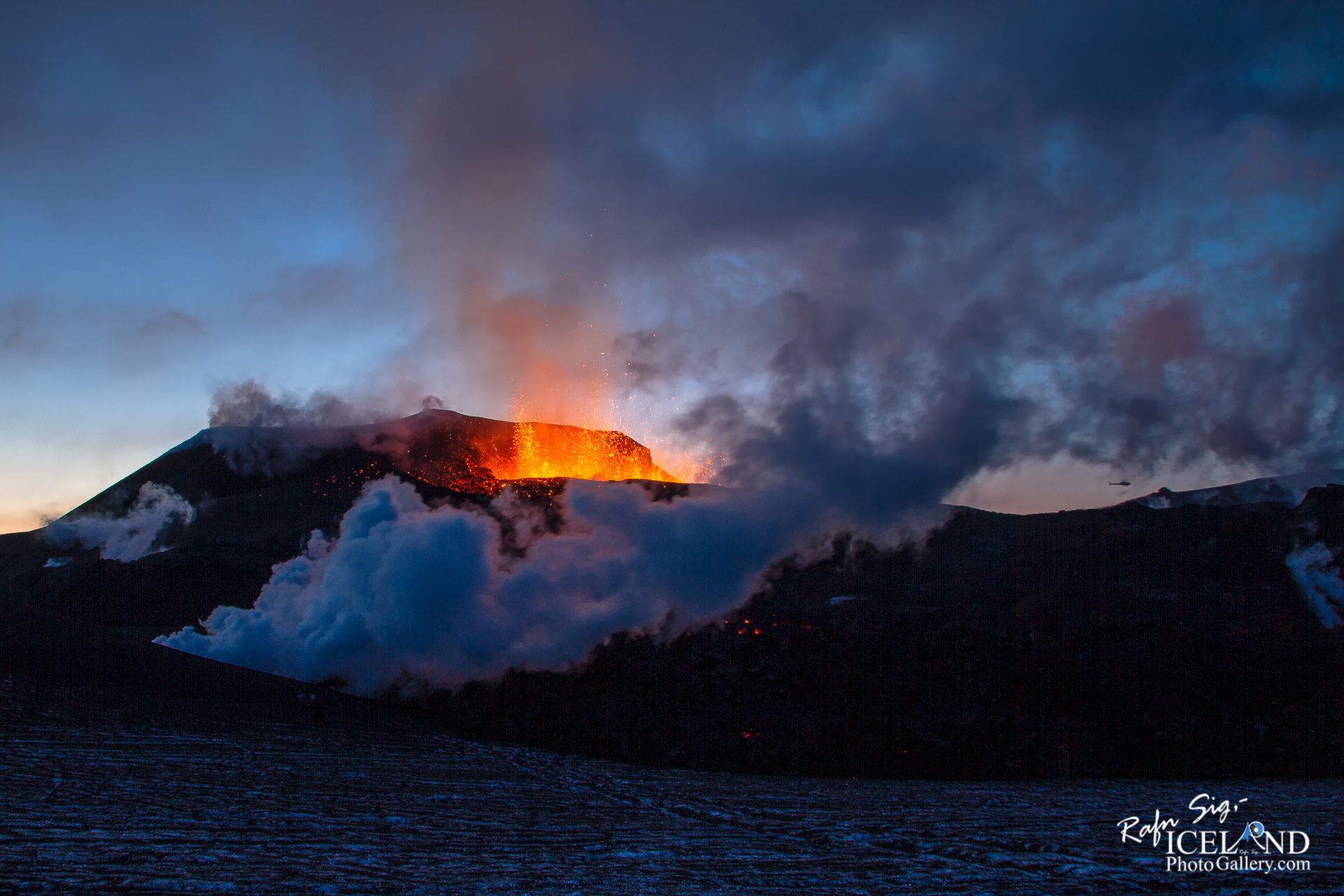
Eldgosið á Fimmvörðuhálsi var eldgos á Fimmvörðuhálsi, sem hófst skömmu fyrir miðnætti þann 20. mars 2010 og stóð til 13. apríl sama ár. Upphaflega bárust fregnir frá Lögreglunni á Hvolsvelli um eldgos og tilheyrandi öskufalli í eða við Eyjafjallajökul. Síðar kom í ljós að gosið var hraungos norðarlega í Fimmvörðuhálsi, rétt austan við Eyjafjallajökul. Hraunrennslið úr gossprungunni myndaði um 200 metra hraunfoss, þann hæsta í heimi, og rann hraunið niður í gil í grennd við gossprunguna.
Þá var gosinu lokið 13. apríl 2010. Strax daginn eftir hófst eldgos í toppgíg Eyjafjallajökuls. Gígarnir tveir sem mynduðust í gosinu hlutu síðar nöfnin Magni og Móði og hraunið sem rann frá þeim kallast Goðahraun.
– 0 –
Fimmvörðuháls (“five cairns pass”) is the area between the glaciers Eyjafjallajökull and Mýrdalsjökull in southern Iceland.
On 20 March 2010, an eruption of the Eyjafjallajökull volcano began in Fimmvörðuháls following months of small earthquakes under the Eyjafjallajökull glacier. The eruption began around 23:00 and opened a 0.5 km (0.31 mi) long fissure vent on the northern part of the pass. Just over a week later, the Fimmvörðuháls eruption produced a 300-meter (980 ft)-long fissure and new craters were seen erupting on a northward path toward the area of Thórsmörk, a popular tourist nature preserve, prompting tours to stop briefly as volcanologists assessed the situation further. The two new craters at Fimmvörduháls were named Magni and Móði, after the sons of . . . All info at: https://www.patreon.com/RafnSig
Subscribe to my Youtube Channel
You can buy this and other photos at my Icelandic Stock Photo Web: IcelandStockPhotos.com
As a native photographer I feel responsible to leave all I can behind to show how it looked like, with my photography, before it’s too late.


Love your work
Great Photography
Gread work. Keep it up
I love your work dude
Like it.
I look at you as my mentor in Photography – Thank you
good material thanks h