
2022-08-18
Hjörleifshöfði in the morning glow │ Iceland Photo Gallery
Documenting Iceland
by: Rafn Sig,-
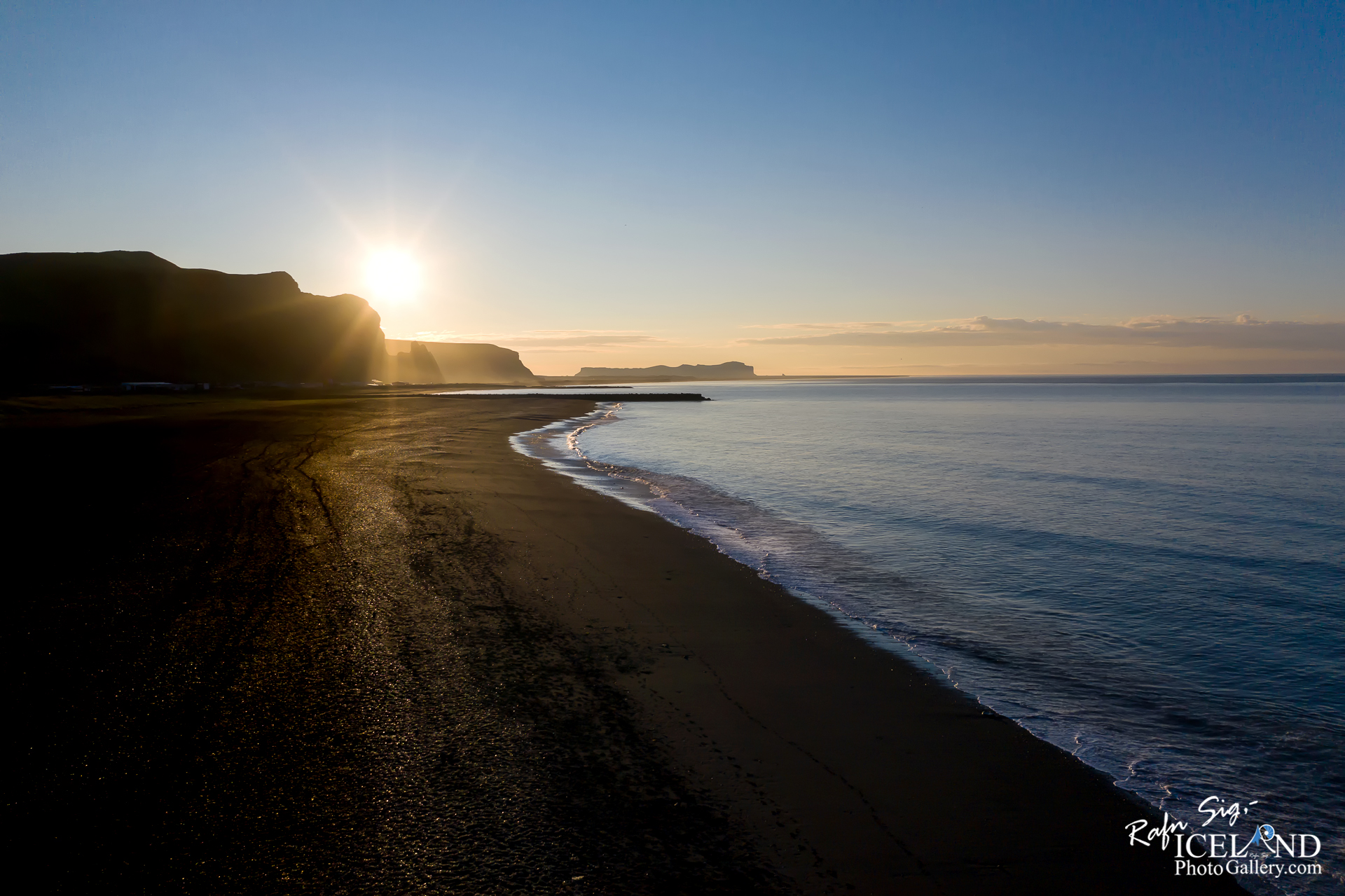
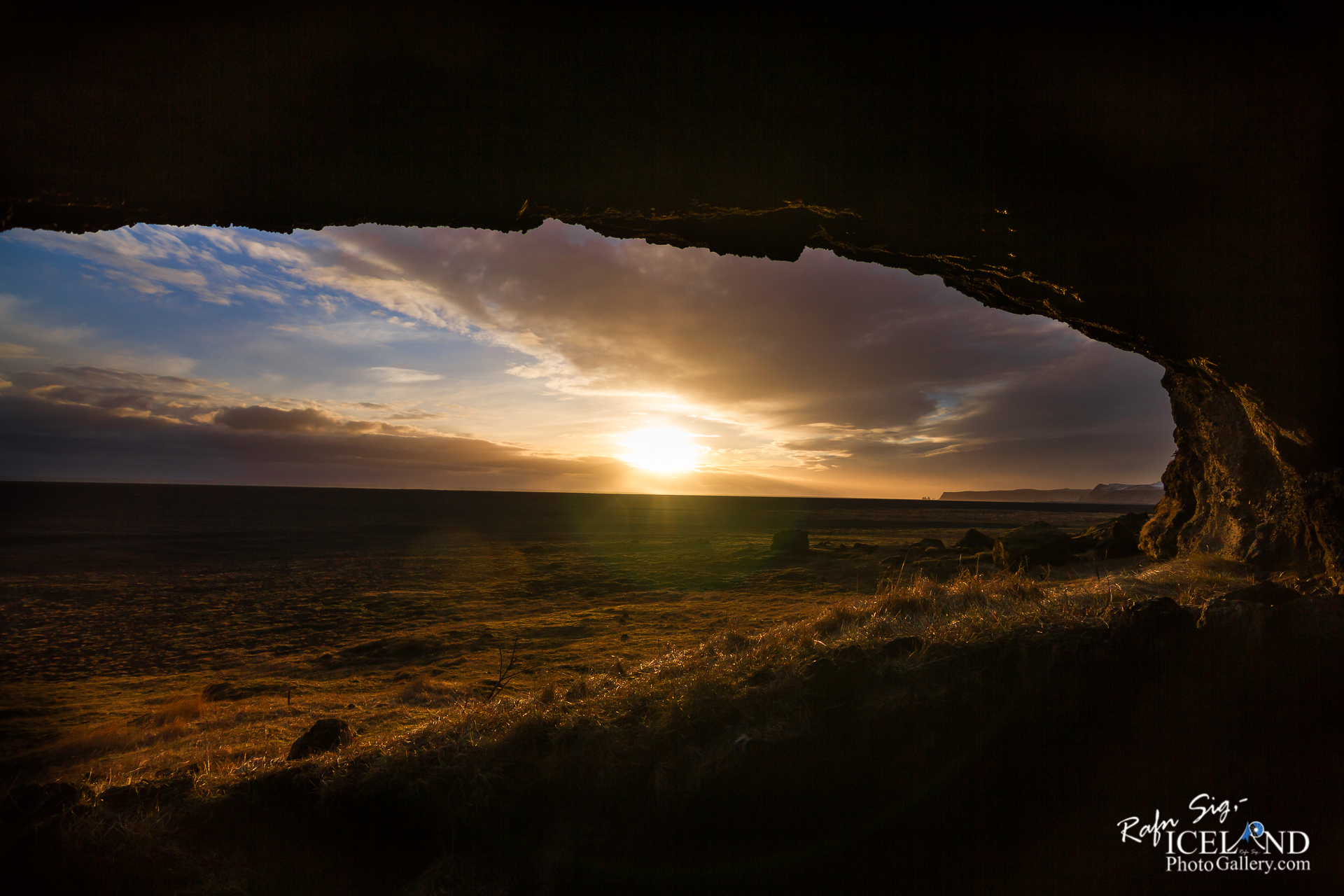
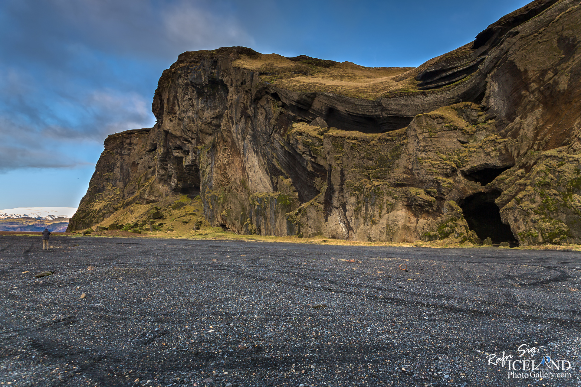
Hjörleifshöfði er móbergshöfði á Mýrdalssandi, 221 m hár. Hann hefur eitt sinn verið eyja, á landnámsöld var hann orðinn landfastur og fjörður, Kerlingarfjörður, var inn með honum en nú er hann umlukinn sandi og er rúma 2 km frá sjó. Þegar Katla gýs bera Kötluhlaup með sér geysilegt magn af sandi og það eru þau sem hafa valdið hinum miklu landbreytingum. Talið er að fjörðurinn hafi fyllst af sandi á 14. öld og síðan hefur landið gengið lengra fram. Sandurinn sunnan við höfðann heitir Kötlutangi og varð syðsti oddi Íslands eftir Kötluhlaupið 1918 en áður var Dyrhólaey syðst. Nú hefur sjórinn brotið mikið af sandi af Kötlutanga síðan 1918, en hann er þó enn syðsti oddi Íslands, nær næstum 500 m sunnar en Dyrhólaey (í ágúst 2017).
Hjörleifshöfði er sagður kenndur við Hjörleif Hróðmarsson, fóstbróður Ingólfs Arnarsonar, sem kom með honum til Íslands á öðru skipi. Þeir urðu viðskila og hafði Ingólfur vetursetu í Ingólfshöfða en Hjörleifur við Hjörleifshöfða. Um vorið drápu írskir þrælar Hjörleifs hann og menn hans, tóku konurnar með sér og flúðu til Vestmannaeyja en Ingólfur elti þá uppi og drap þá. Uppi á höfðanum er Hjörleifshaugur og er Hjörleifur sagður grafinn þar.
Búið var í Hjörleifshöfða til 1936 en bærinn var fluttur af sandinum upp á höfðann eftir að hann eyddist í Kötluhlaupinu 1721. Hjörleifshöfði þótti góð bújörð og þar voru hlunnindi af reka, fuglaveiðum og eggjatekju.
Hjörleifshöfði is a 221 m (725 ft)-high inselberg in southern Iceland. It consists of palagonite. The mountain is located on the Mýrdalssandur outwash plain about 15 km (9.3 mi) east of Vík í Mýrdal, and was an island in the Atlantic Ocean. The mountain is of volcanic origin but was covered by ice or seawater at the time of its formation, so it has a similar past as the nearby larger Hafursey mountain. Then it was an island surrounded by sea. At the time of the settlement of Iceland, it was already connected to the mainland, but there was still a fjord at its side, which was used to shore ships.
Later, the jökulhlaups, connected with the eruptions of the Katla volcano in Mýrdalsjökull, gathered so much sand and gravel that it was now not at the shore but surrounded by the mainland and the fjord was filled.
After the eruption of Katla in 1918, a tongue of land, Kötlutangi, led out into the sea so far that it was regarded as the southernmost point of Iceland. Meanwhile, however, the sea eroded it to the point that this title again belongs to the peninsula of Dyrhólaey
The name was given to the mountain by one of the first legendary settlers mentioned in the Landnámabók.
According to this, Hjörleifr Hróðmarsson was the brother-in-law of Ingólfur Arnarson, Iceland’s first official settler. He settled at Hjörleifshöfði towards the end of the ninth century. There, however, he was slain by his slaves. The slaves fled to Vestmannaeyjar, where Ingólfur took his revenge for his friend and slew them.
On the top of the mountain is a mound called Hjörleifshaugur, where Hjörleifr is said to be buried
. . . All info at: https://www.patreon.com/RafnSig
Subscribe to my Youtube Channel
You can buy this and other photos at my Icelandic Stock Photo Web: IcelandStockPhotos.com
Liked it?
Take a second to support me on Patreon

Viltu styrkja þessa síðu?
Vefsíðan Iceland Photo Gallery er unnin í sjálfboðavinnu. Ef þú hefur áhuga á að styrkja þetta framtak til áframhaldandi uppbyggingar er hægt að leggja inn á:
Reikningsnr.: 0101-26-013169
Kennitala: 310155-4469


0 Comments