
2020-03-12
Documenting Iceland
Hrauneyjalón Lagoon │ Iceland Highland Landscape Photography
by: Rafn Sig,-
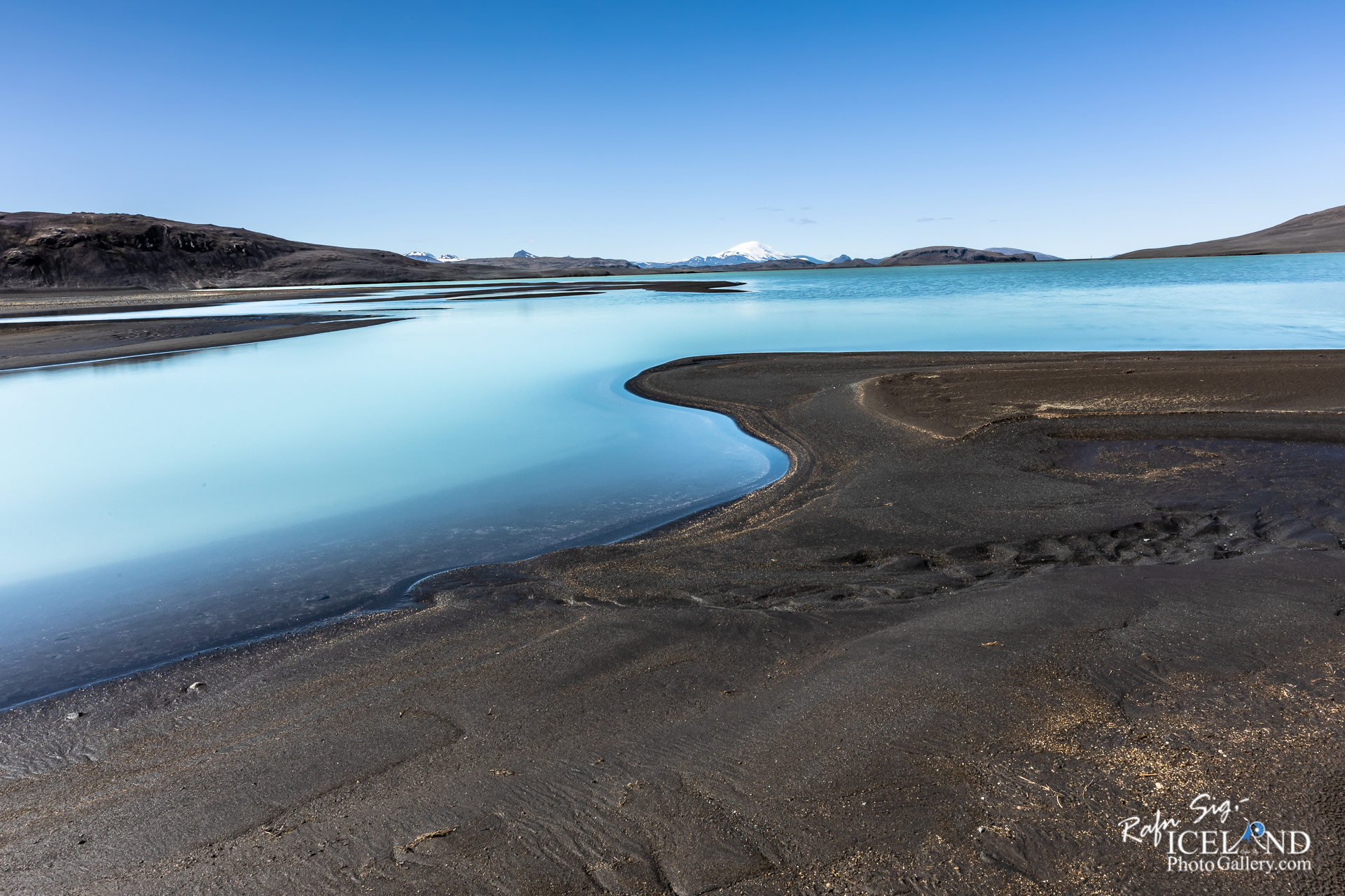
The Tungnaá River is dammed on rather flat land approximately 1.5 km above the Hrauneyjafoss Waterfall and 7 km below the Sigalda Station. The difference in altitude is approximately 15 m. Hrauneyjalón, an 8.8 km² reservoir, was formed by the dam. A low soil wall dam stretches along the lava flatlands on the south bank of the river. A headrace channel runs 1 km northwards from the reservoir through a dip in the Fossalda Hill to an intake point at its northern edge. Three steel penstocks (4.8 m in diameter) run 272 m down the hill to the powerhouse. The tailrace canal, just over one kilometre in length, enters the Spordöldukvísl waterway, which runs into the Tungnaá River.
.. . . If you would like to join my team of Documenting Iceland, You are welcome: . . . https://www.patreon.com/RafnSig
You can buy this and other photos at my Icelandic Stock Photo Web: IceStockPhotos.com
Liked it?
Take a second to support me on Patreon

As a native photographer I feel responsible to leave all I can behind to show how it looked like, with my photography, before it’s too late.

Help Support This Blog
This blog is offered free of advertising and corporate sponsors, but needs your support. Making an income in art and writing is not easy or consistent. If you find these essays useful, please consider showing your appreciation by making a small donation.


0 Comments