
2021-12-21
Hverfell volcano │ Iceland Photo Gallery
Documenting Iceland
by: Rafn Sig,-
Hverfjall (eða Hverfell) er fjall austan við Mývatn og vestan við Búrfellshraun í Skútustaðahreppi. Hverfjall er eldgígur sem talinn er hafa myndast í öflugu en stuttu þeytigosi fyrir um 2500 árum.
Hverfjall (Hverfell) var friðlýst sem náttúruvætti 22. júní 2011.
Hverfjall (Hverfell) er í röð fegurstu og reglubundnustu öskugígamyndana sem gefur að líta á Íslandi og talinn í röð þeirra stærstu sinnar tegundar á jörðinni. Gígurinn er óvenjulegur að því leyti að gígskálin er álíka djúp og gígurinn er hár. Hann myndaðist í þeytigosi fyrir um 2500 árum. Gígurinn myndaðist í eldgosahrinu sem nefnd hefur verið Hverfjallseldar (orðið eldar er gjarnan notað um síendurtekin eldgos með stuttum hléum í sama eldgosakerfi, en orðið gos vísar frekar til einstakra, stakra atburða eða hrina í lengri atburðarás). Sprungureinin sem Hverfjallseldar komu upp á var um 25 km löng í heild sinni þar sem Hverfjall (Hverfell) var á suðurenda sprungunnar. Gos í sprungurein eru aldrei á einni, samfelldri sprungu heldur skiptist reinin í margar styttri einingar. Hverfjall (Hverfell) sjálft er á syðsta hluta af um 1800 metra langrar sprungu. Annar, mun minni öskugígur skammt norðan gígsins og er talinn hafa myndast í upphafi gossins er myndaði Hverfjall (Hverfell).
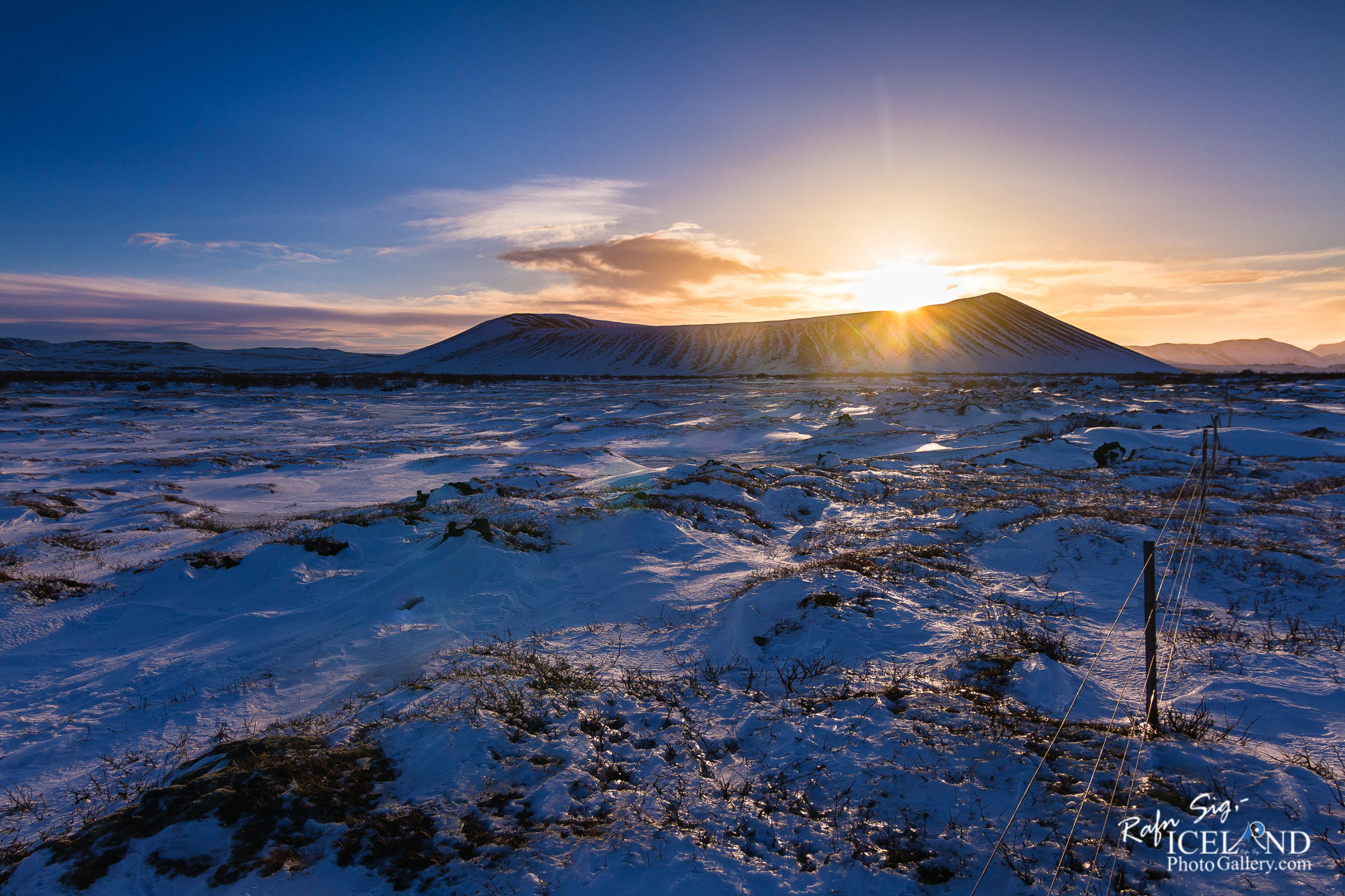
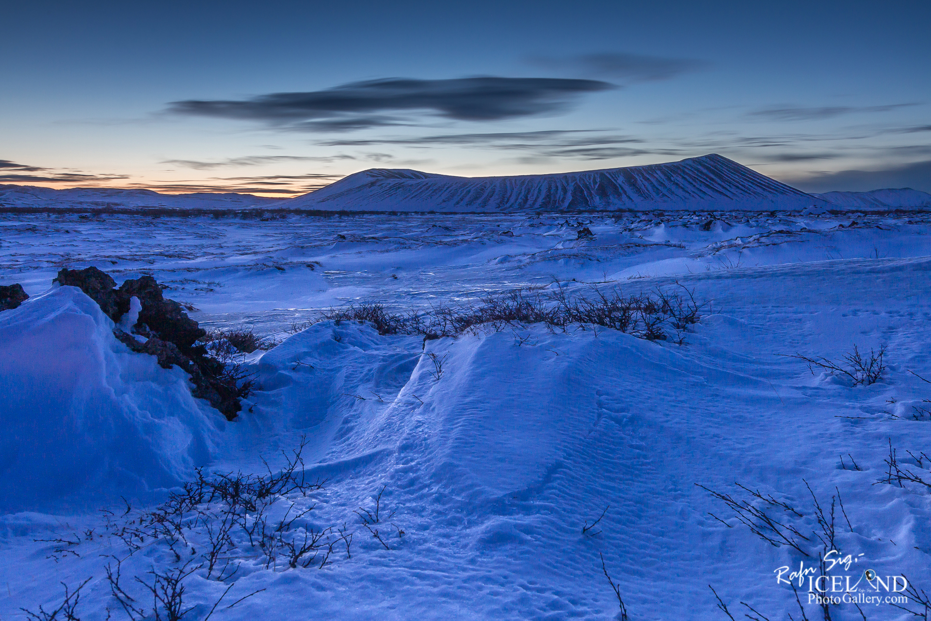
Hverfjall (also known as Hverfell) is a tephra cone or tuff ring volcano in northern Iceland, to the east of Mývatn, Iceland.
Hverfell is located in the Lake Mývatn Area of north Iceland, one of the most volcanic parts of the country due to the fact that it sits directly on the Mid Atlantic Rift. Evidence of this volcanism can be seen everywhere, with many lava fields, hot springs and craters, although Hverfell is perhaps the most classic example.
With a diametre of a kilometre and a depth of 140 metres, it is a dramatic site to behold; it is, in fact, one of the largest explosion craters in the world. It can be hiked around although only by sticking to the path, as the surrounding nature is very delicate.
The eruption that created Hverfell occurred just under 3,000 years ago. Iceland was uninhabited by people at that time, although that is not to say its eruption had no effect. Many of the eruptions in the Mývatn area have caused great ash clouds that have cooled the temperature across Europe, devastated agriculture, poisoned rivers and blocked ports.
Most famously, the eruption of Laki in the 18th Century is believed to have caused the famine that, in part, lead to the French Revolution and the subsequent surge of liberalism as a global movement.
Explosion craters like Hverfell are formed when there is a sudden ejection of material that erupts at or near the surface of the earth with enormous force. Later, erosion from the wind and rain cause these craters to have the ‘lip’ that encircles them. While Hverfell is, of course, naturally created, not all explosion craters are; in Germany, a massive blast at an ammunitions factory left a similar phenomenon. Bomb strikes often also leave such craters.
. . . All info at: https://www.patreon.com/RafnSig
Subscribe to my Youtube Channel
You can buy this and other photos at my Icelandic Stock Photo Web: IcelandStockPhotos.com

Liked it?
Take a second to support me on Patreon

As a native photographer I feel responsible to leave all I can behind to show how it looked like, with my photography, before it’s too late.


0 Comments