
2020-12-30
Kerlingarfjöll Geothermal Highlands │ Iceland Landscape Photography
Documenting Iceland
by: Rafn Sig,-
English below
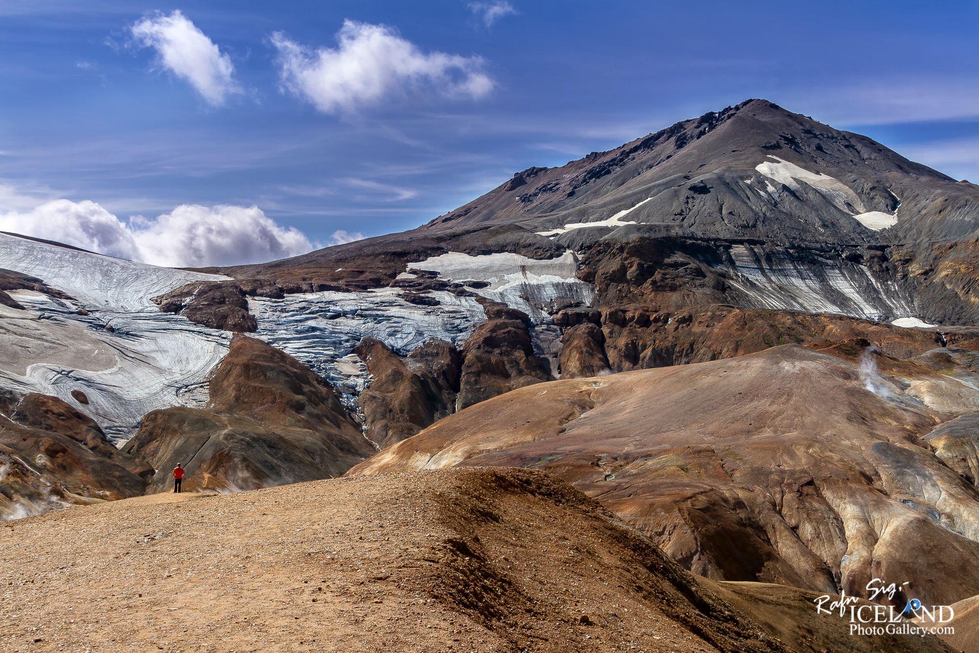
Kerlingarfjöll er fjallgarður á hálendi Íslands nálægt Kili. Jarðvegur er sums staðar rauður á svæðinu vegna eldvirkni þar. Jarðefni úr hverum á svæðinu eru gul, rauð og græn. Hveradalir eru aðalhverasvæðið þar. Vinsælt skíðasvæði var í Kerlingarfjöllum en það var aflagt árið 2000. Aðstaða er fyrir ferðamenn í Kerlingarfjöllum en Skíðaskóli var stofnaður þar árið 1961. Þekktir tindar þar eru Loðmundur, Snækollur, Fannborg, Höttur, Ögmundur og Kerlingartindur. Snækollur er þeirra hæstur eða 1488 metrar. Fjöllin eru nefnd eftir móbergsdranga við Kerlingartind, Kerlingu.
Árið 2020 voru fjöllin og svæði umhverfis friðlýst, 344 ferkílómetrar
– 0 –
Kerlingarfjöll (1,477 m (4,846 ft)) is a mountain range in Iceland situated in the Highlands of Iceland near the Kjölur highland road. The volcanic origin of these mountains is evidenced by the numerous hot springs and rivulets in the area. And indeed, they are part of a large volcano system of 100km² (38.6 square mile). The volcanoes of the range are. . . All info at: https://www.patreon.com/RafnSig
Subscribe to my Youtube Channel
You can buy this and other photos at my Icelandic Stock Photo Web: IcelandStockPhotos.com
Liked it?
Take a second to support me on Patreon

As a native photographer I feel responsible to leave all I can behind to show how it looked like, with my photography, before it’s too late.

Help Support This Blog
This blog is offered free of advertising and corporate sponsors, but needs your support. Making an income in art and writing is not easy or consistent. If you find these essays useful, please consider showing your appreciation by making a small donation.


This is Professional
Love your work
Wooooow. Really love your work
Woooow. What a shot
You are the best photographer I have come across