
2020-03-29
Kleifarvatn, Hellutinda and Vatnshlíð from air│ Iceland Landscape photography
Documenting Iceland (2013)
by: Rafn Sig,-
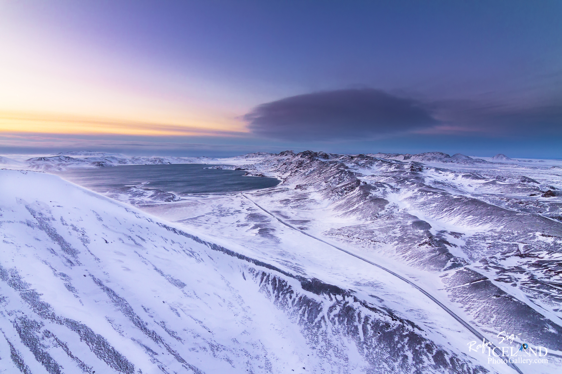
The lake Kleifarvatn is about 10 km². It is the largest of Reykjanes peninsula and the third largest of southern Iceland. It is about 97 m deep and one of the deepest lakes in Iceland. It is located on the fissure zone of the Mid-Atlantic Ridge. Their movements, as they pull apart, are what cause this region to have so many eruptions and earthquakes.
The lake has no visible water coming in or going out as most of its water comes and leaves underground. Its catchment area is small and it has a very limited discharge on the surface. The lake has diminished since year 2000 because of two major earthquakes, which probably opened up fissures at its bottom. In the sixties char fries from Lake Hlidarvatn were released into the lake and have thrived quite well.
In the southernmost part a hot water from some hot springs runs into the lake but elsewhere the lake is very cold. A small fishing lodge is located by the lake. Great place for photographers because of the volcanic surroundings of the lake are unique and beautiful. The story says that a monster in the shape of a worm and size of a medium sized whale lives in the lake
Check out: Öxarárfoss waterfall in Þingvellir National Park, Iceland
. . . I need your support: . . . https://www.patreon.com/RafnSig
You can buy this and other photos at my Icelandic Stock Photo Web: IceStockPhotos.com
Liked it?
Take a second to support me on Patreon

As a native photographer I feel responsible to leave all I can behind to show how it looked like, with my photography, before it’s too late.

Help Support This Blog
This blog is offered free of advertising and corporate sponsors, but needs your support. Making an income in art and writing is not easy or consistent. If you find these essays useful, please consider showing your appreciation by making a small donation.


0 Comments