2023-08-03
Lauffellsmýrar Wetlands │ Iceland Photo Gallery
Documenting Iceland
by: Rafn Sig,-
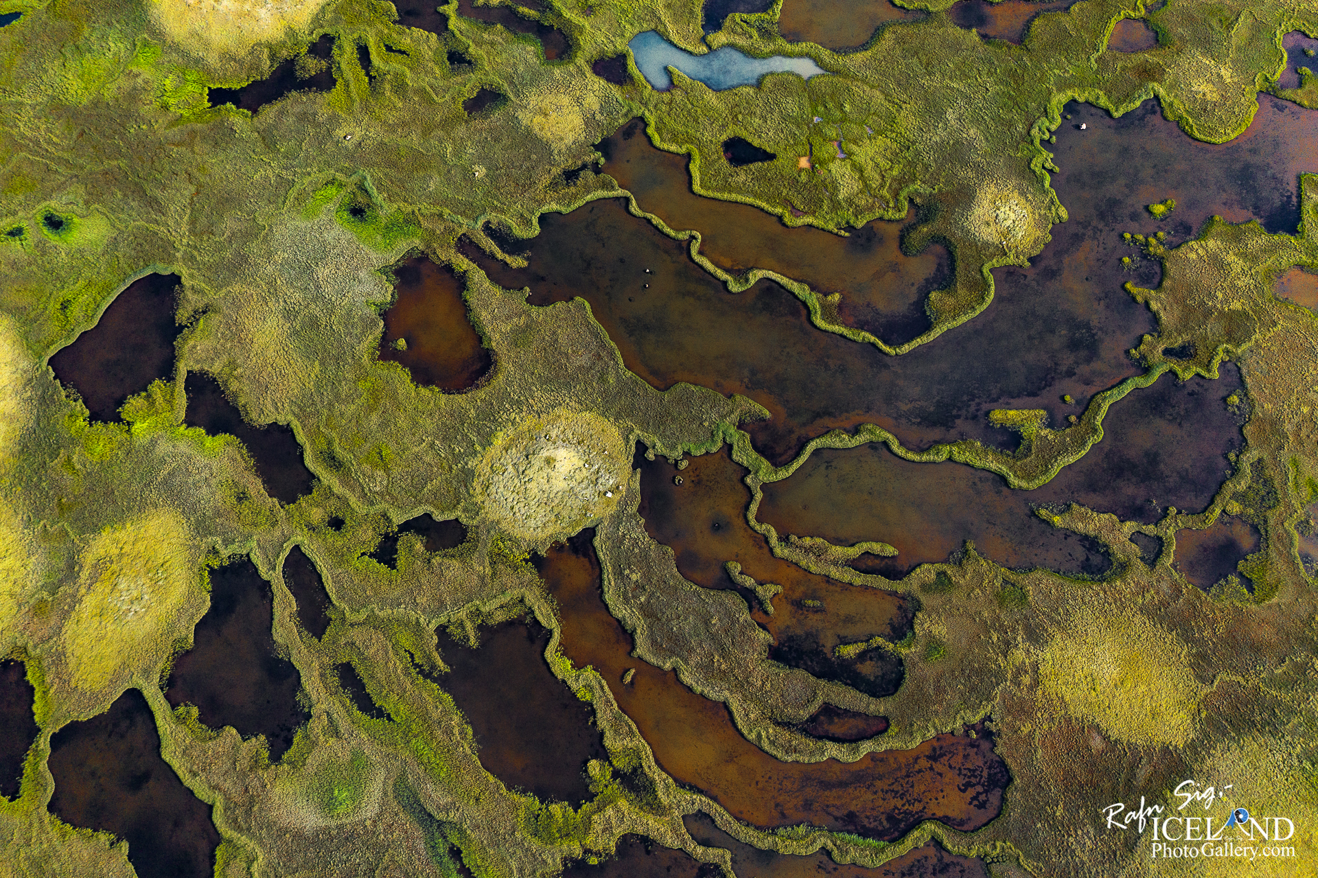
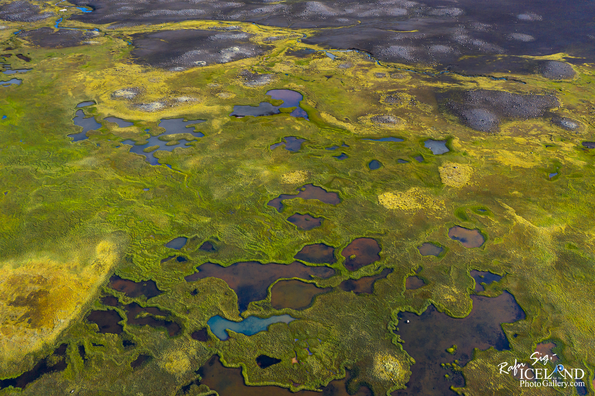
Lauffellsmýrar er svæði tilnefnt á náttúruminjaskrá vegna vistgerða á landi. Þar eru víðáttumestu rimamýrar á landinu en rimamýravist er sjaldgæf vistgerð. Rimamýrar einkennast af áberandi mynstri langra rima og forblautra flóalægða og tjarna á milli sem liggja þvert á eða lítilsháttar í sveig undan landhalla. Á rimum vex mólendis- og deiglendisgróður en flóagróður í lægðum. Rimamýrar eru fremur frjósamar og fuglalíf þeirra er talið allríkulegt. Svæðið nær yfir um 55,9km2
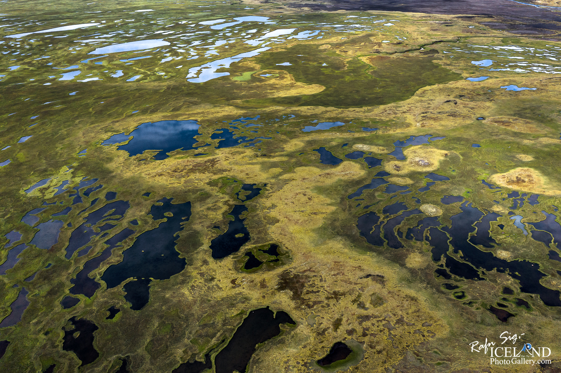
Lauffellsmýrar liggja í tæplega 500 m hæð yfir sjó á hallalítilli bungu sem lækkar til suðvesturs og vesturs. Sunnan og austan mýranna fer land hækkandi. Hellisá fellur niður um svæðið og til Skaftár sunnan Leiðólfsfells. Stærstu mýraflákarnir eru sunnan Hellisár en einnig eru stórar mýrabreiður norðan árinnar að Skaftáreldhrauni. Landslag bendir til að hraunið hafi runnið yfir hluta mýranna og skert þær, en vestan hrauns eru svipaðar mýrar í Hrossatungum og Stórakrók. Lauffellsmýrar eru ósnortnar af framkvæmdum, Lakavegur liggur ofan og við austurjaðar þeirra. Sauðfé gengur til beitar á Lauffellsmýrum á sumrin eins og annarsstaðar á Síðumannaafrétti. Mýrarnar voru fyrrum heyjaðar í grasleysisárum.
Laufellsmýrar is an area designated on the natural heritage register due to terrestrial ecosystems. There are the most extensive rime bogs in the country, but rime bogs are a rare ecosystem. Rim marshes are characterized by a distinct pattern of long rims and pre-wet bay depressions and ponds in between that lie across or slightly in a curve from the slope of the land. Peatland and peatland vegetation grows on ridges, while bay vegetation grows in depressions. Rimamyrar are rather fertile and their bird life is considered to be very rich. The area covers about 55.9km2
Laufellsmyrar lies at an altitude of almost 500 m above sea level on a gently sloping hump that descends to the southwest and west. To the south and east of the marshes, the land rises. Hellisá falls through the area and to Skaftár south of Leiðólfsfell. The largest marshes are south of Hellisár, but there are also large swathes north of the river to the Skaftáreldhrauni. The landscape suggests that the lava flowed over parts of the marshes and cut them, but to the west of the lava there are similar marshes in Hrossatungur and Stórakrók. Laufellsmyr are untouched by construction, Lakavegur runs above and along their eastern edge. Sheep graze on Lauffellsmýr in the summer, as elsewhere on Síðumnaafrétt. The marshes used to be hayed in years of grass loss.
. . . All info at: https://www.patreon.com/RafnSig


– 0 –
Liked it?
Take a second to support me on Patreon

Viltu styrkja þessa síðu?
Vefsíðan Iceland Photo Gallery er unnin í sjálfboðavinnu. Ef þú hefur áhuga á að styrkja þetta framtak til áframhaldandi uppbyggingar er hægt að leggja inn á:
Reikningsnr.: 0101-26-013169
Kennitala: 310155-4469