
2022-03-06
Markarfljótsfoss in Markarfljótsgljúfri │ Iceland Photo Gallery
Documenting Iceland
by: Rafn Sig,-
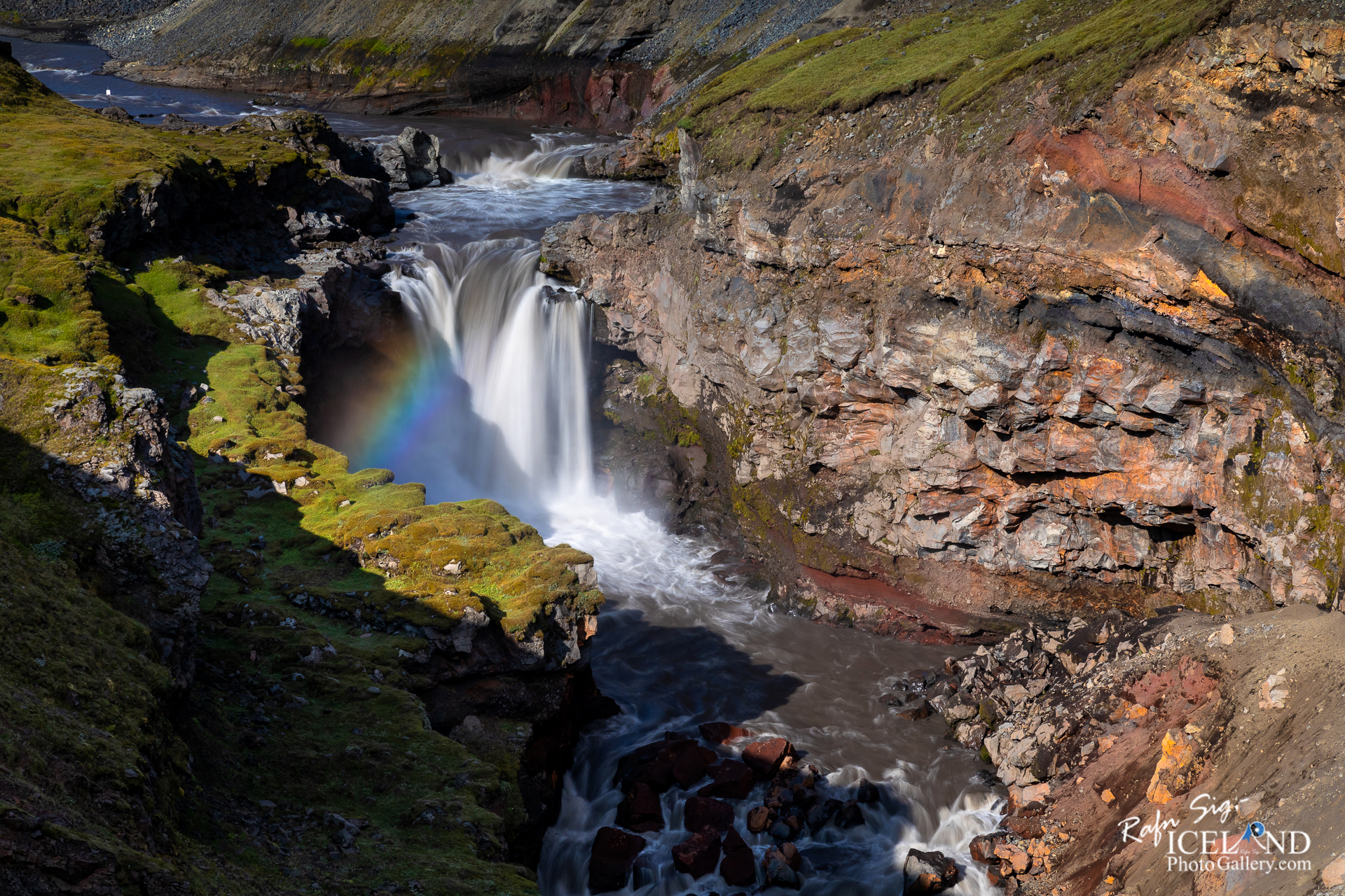
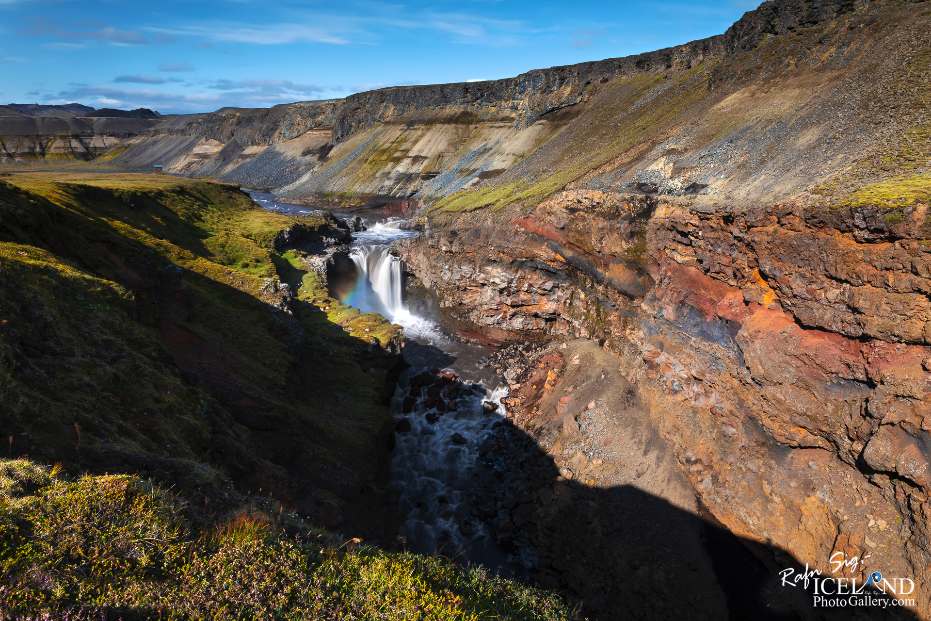
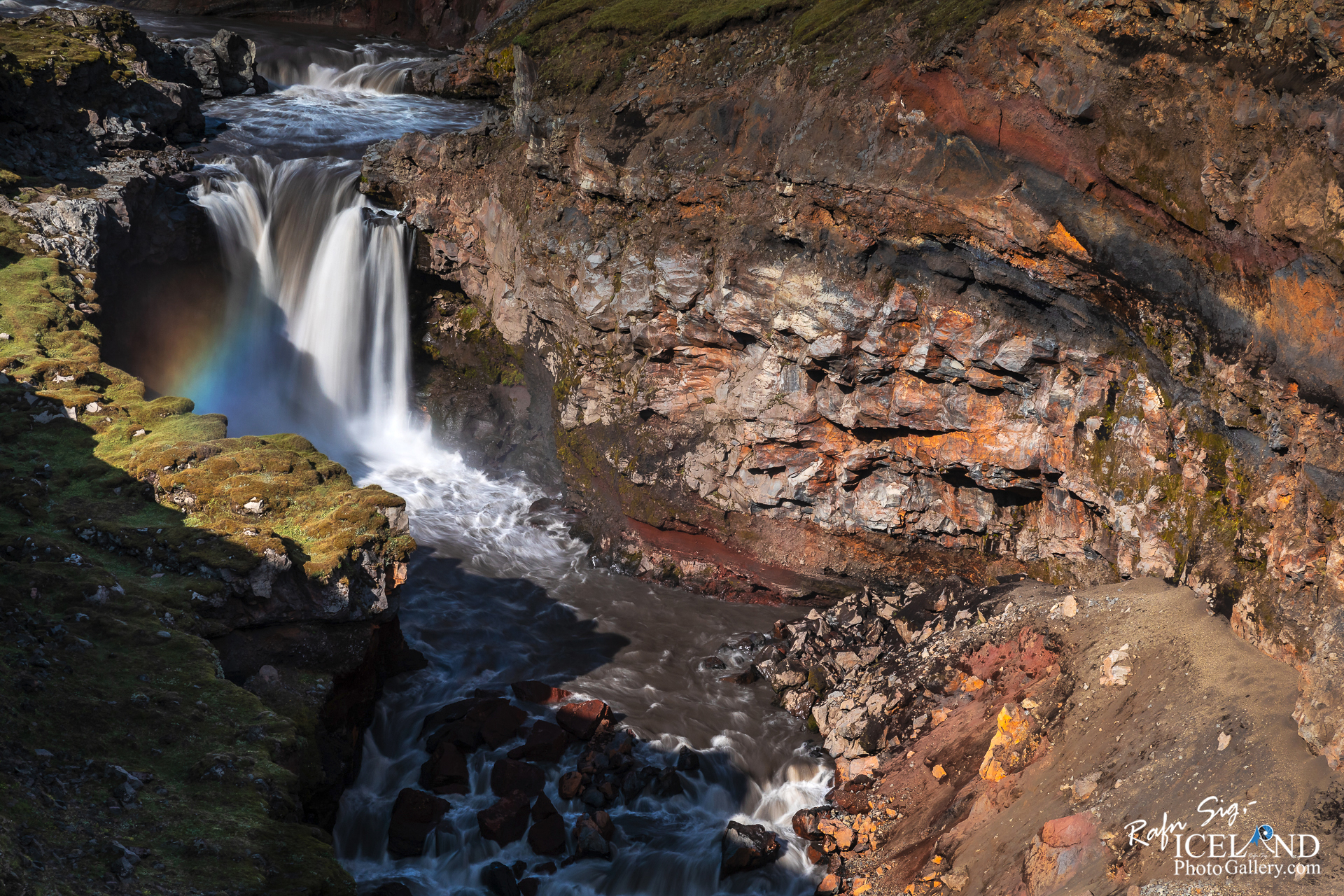
Austan við Tindafjallajökul liggur hið tilkomumikla 200 metra djúpa Markarfljótsgljúfur sem Markarfljót, eina stærstu á Suðurlands hefur sorfið niður. Áin, er um 100 km löng og helstu upptök hennar eru í Mýrdalsjökli og Eyjafjallajökli, vatnasviðið er gríðarstórt, eða um 1200 km2. Markarfljót hefur borið milljónir tonna af sandi og seti niður á láglendi og á haf út og skapað svæði eins og Landeyjarsand og landið vestan Eyjafjalla. Árbotninn úr Markarfljóti er þekktur sem Markarfljótsaurar. Skammt frá skálanum Mosi á Emstruleið er kröftugur drullugur foss í mjóu gljúfrinu sem ég kalla Markarfljótsfoss því ég hef ekki fundið hið rétta nafn sem hann ber.
East of Tindafjallajökull Glacier lies the impressive 200m deep Markarfljótsgljúfur Gorge which was carved out the land by the Markarfljót River, one of South Iceland’s largest rivers. The 100km long river, whose main sources are located in Mýrdalsjökull and Eyjafjallajökull Glaciers, has an enormous 1200km2 catchment area. Markarfljót has carried millions of tons of sand and sediment down to the lowlands and out to sea, creating areas such as Landeyjarsandur and the land west of Eyjafjall. The riverbed deposit area from Markarfljót is known as Markarfljótsaurar. Not far from the cabin Mosi on Emstruleið is a powerful muddy waterfall in the narrow canyon.
. . . All info at: https://www.patreon.com/RafnSig
Subscribe to my Youtube Channel
You can buy this and other photos at my Icelandic Stock Photo Web: IcelandStockPhotos.com
Liked it?
Take a second to support me on Patreon

As a native photographer I feel responsible to leave all I can behind to show how it looked like, with my photography, before it’s too late.


0 Comments