
2018-27-12
Documenting Austurengjahver before it’s too late
by: Rafn Sig,-
From the first time I came to Austurengjahver with my wife Eden in the
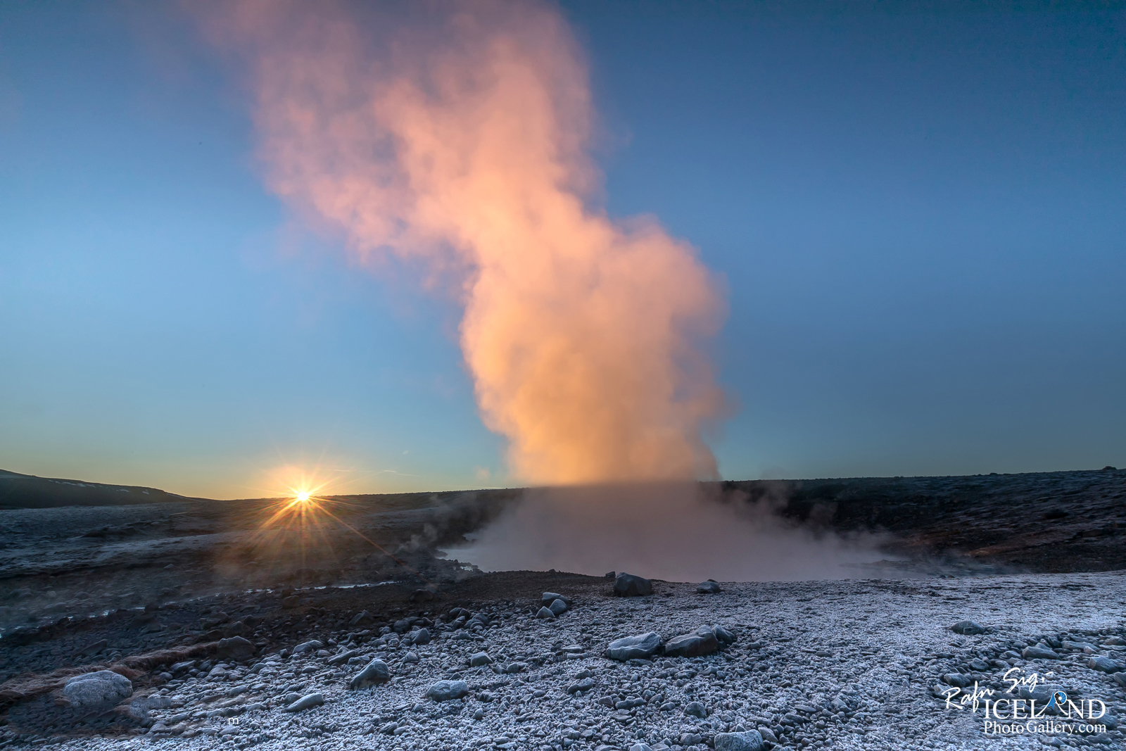
 summer of 2017, I k new I had to be back to document the first sunrays before it would be too late. I really wanted to see the contrast line between the light and the shadows and I wanted to see if I could get the first sunrays coming up from the hill. This is only possible for a short period of time and then it’s not so easy to get there in the winter time. The following winter of 2017 and beginning of 2018 I tried to go several times but there was always something that prevented me to make it to the geyser. Too much snow – wrong wind direction – cloudy etc. This winter I made it on my third attempt and I’m not disappointed with the outcome.
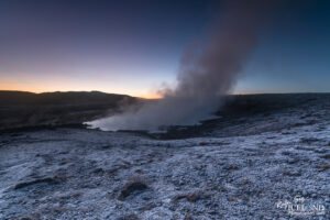
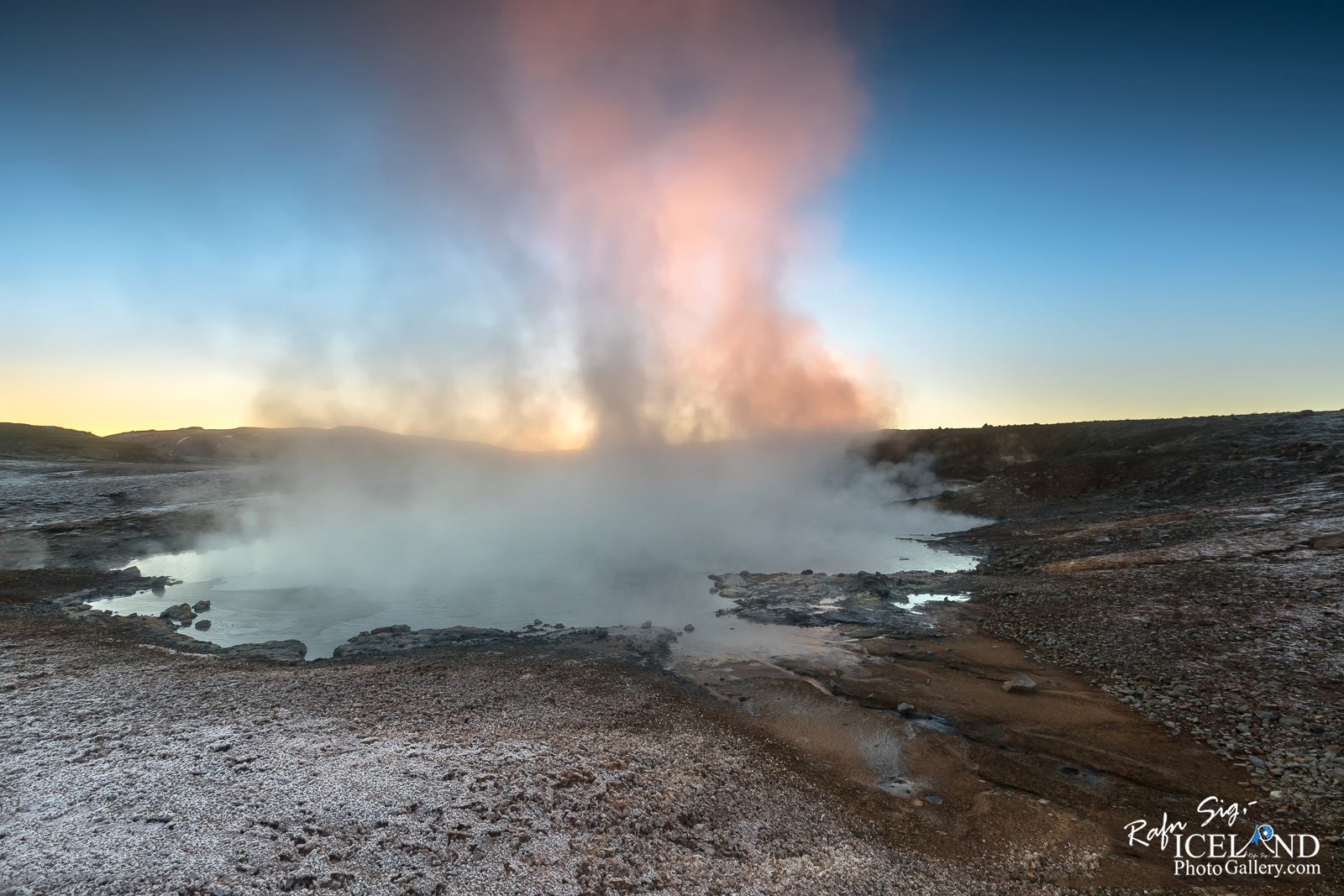
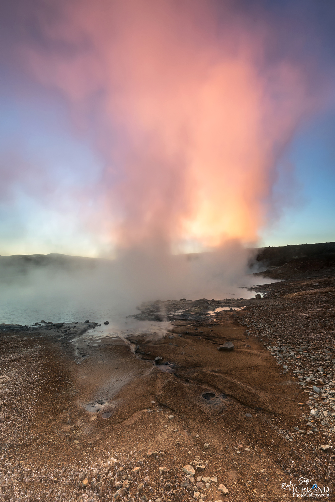
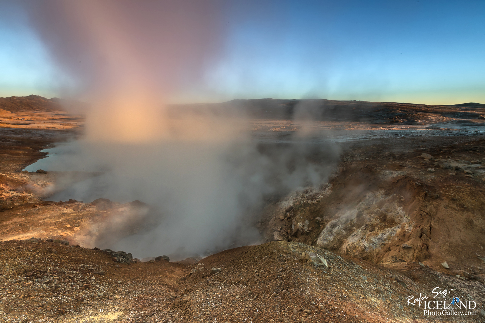
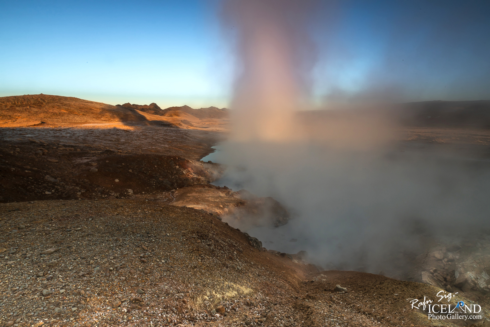
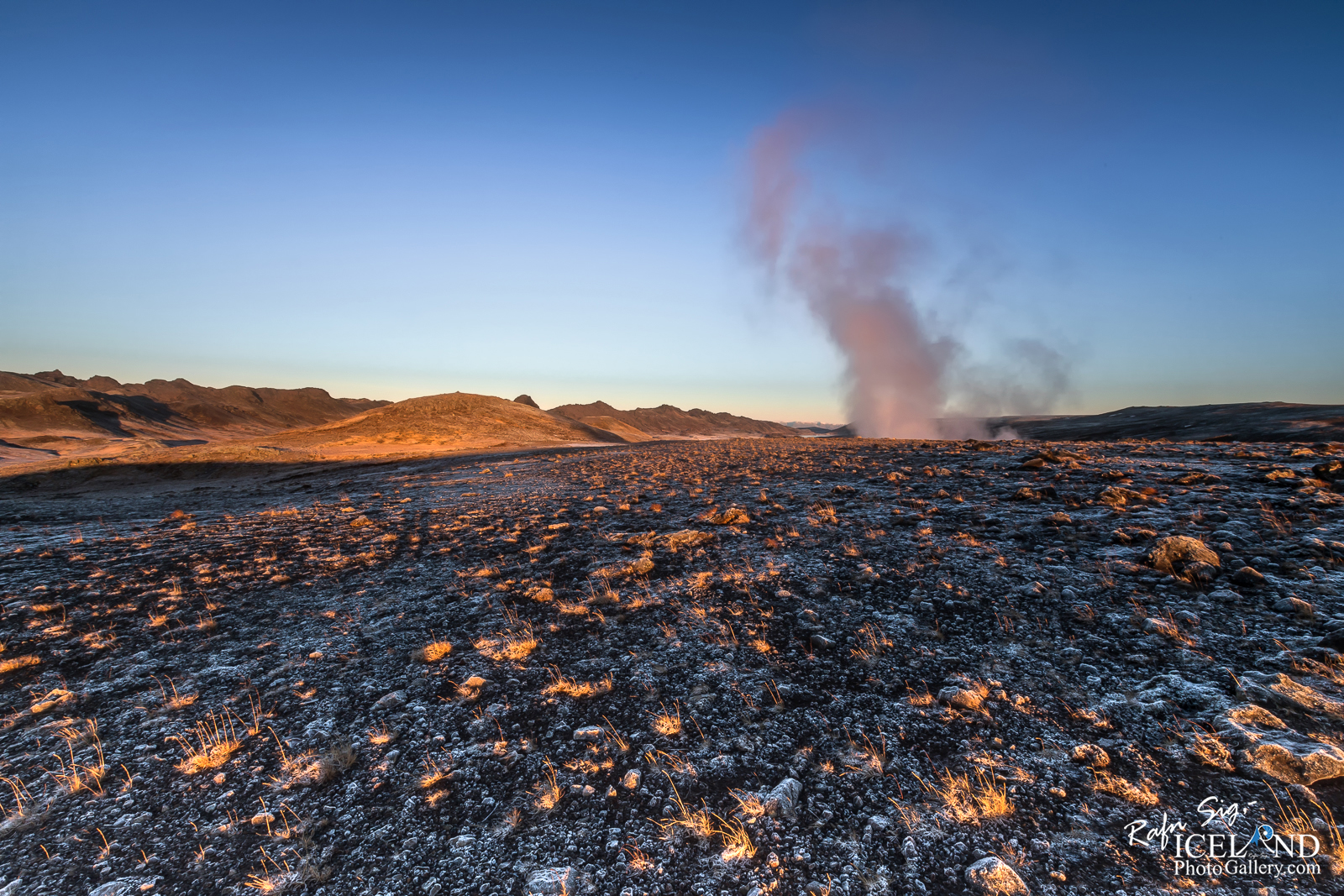
The weather was calm, it was a frosty morning with no snow so the soil was hard with big white frost needles and I had the place for myself. This was on the 22nd of December, the second shortest day in Iceland and I had only 4 hours before it would get dark again.
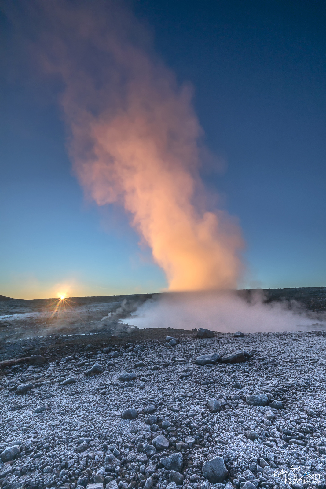
I started my journey around 07:15 from my home and I knew the sun would crawl out around 11:15 (I checked it on my Planit Pro app) so I thought I would have enough time to get up there and explore the place better.
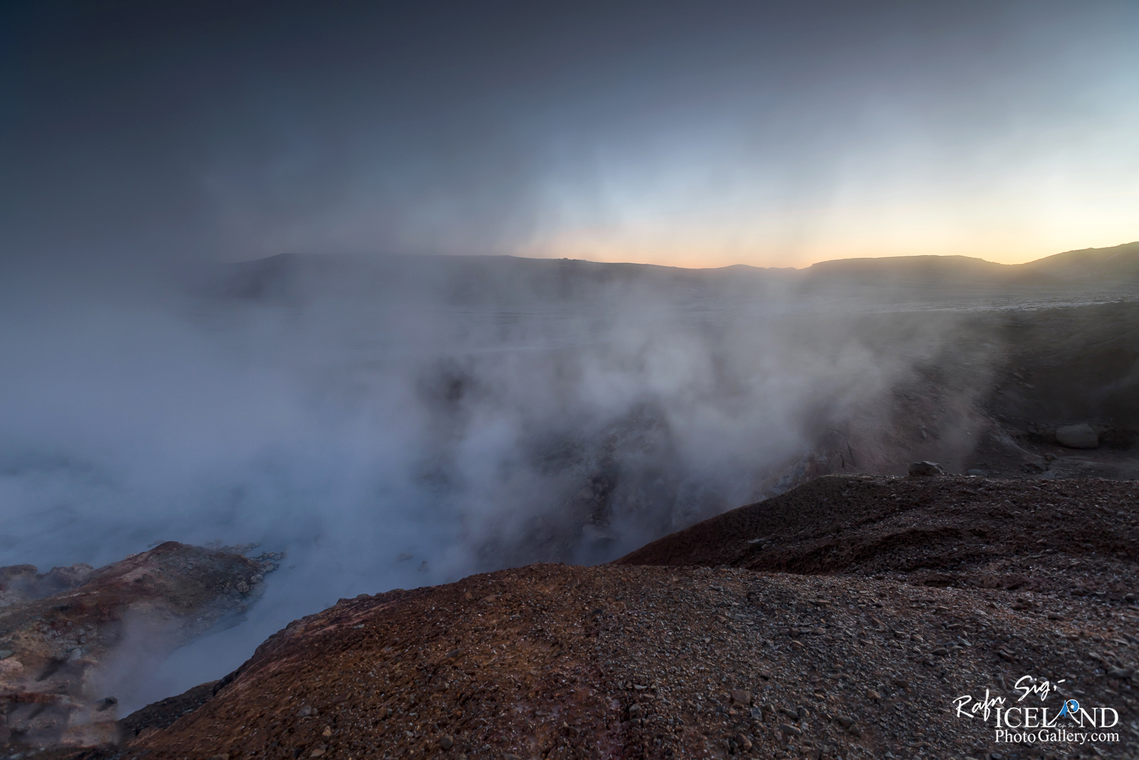
It took me around one hour to walk up the hill, it was dark and I only had a headlight to light up a small dot in front of me and the full Moon shining behind me. It was rather difficult to find the right direction and actually, it would have been impossible if it wasn’t for my GPS. You don’t see the steam coming up as you usually do in the daytime.
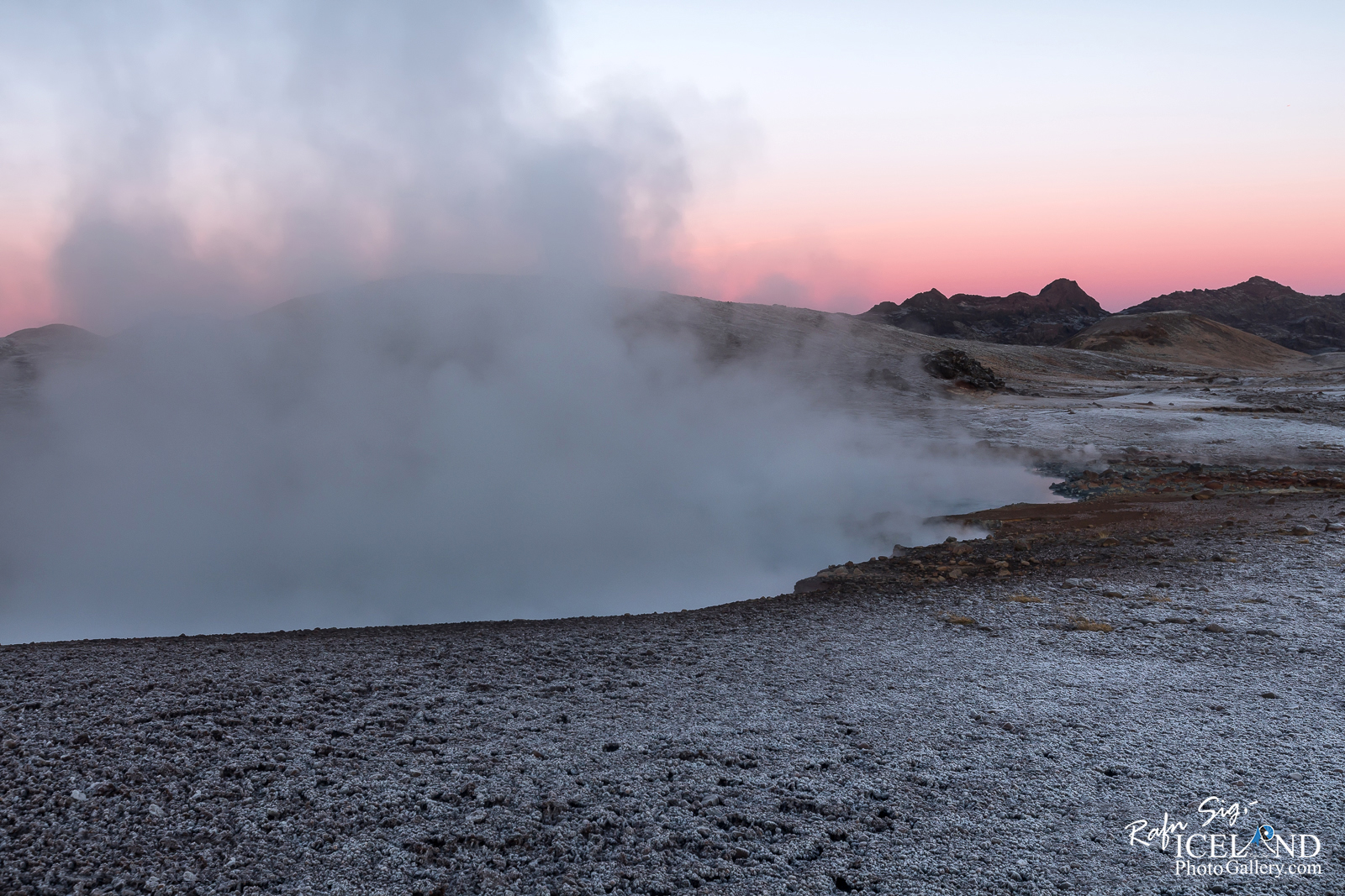
The Mountainside was slippery as it had been frost for the last two days so I had to be careful not falling in the ruffles and the small rills that were on my way but the positive thing was I didn’t make any mark in the soil, so no damage done there. To cut a long story short I was up there an hour before sunrise in total darkness so I was at the right time to get the Blue and Golden hour. I explored the area as much as possible but I found out it was dangerous to be wandering around in the darknes with only the small light..
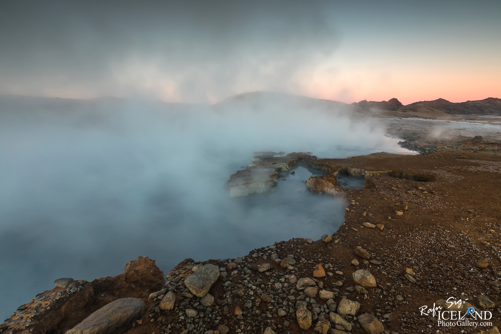
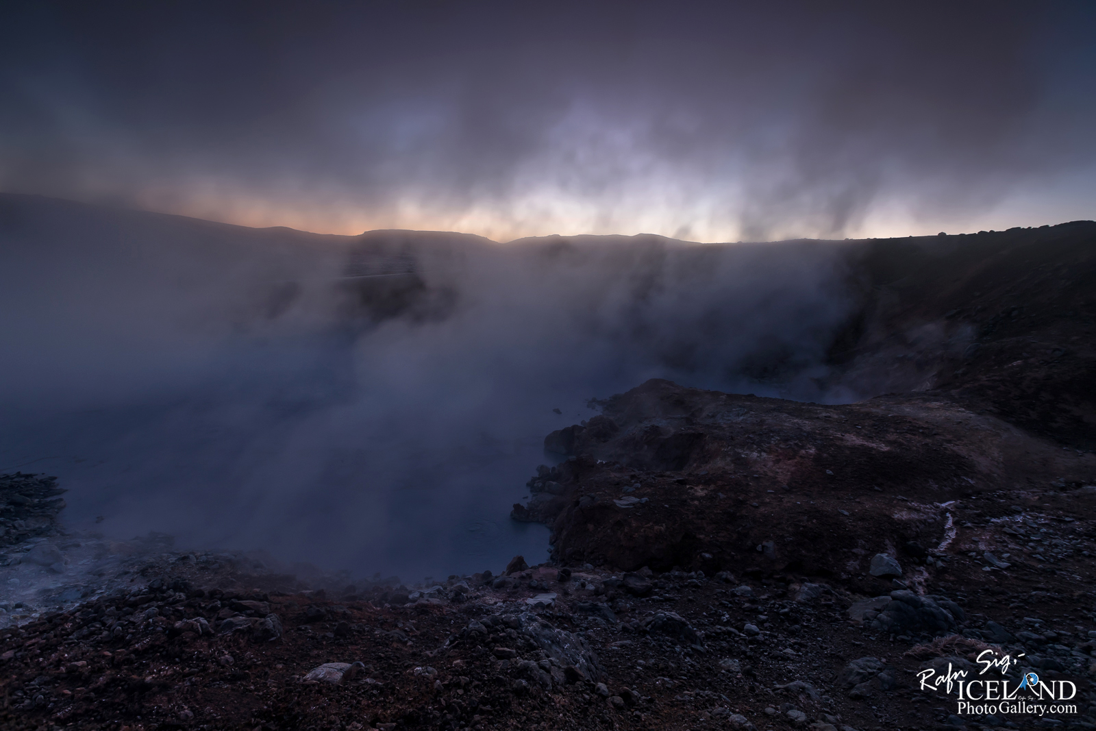
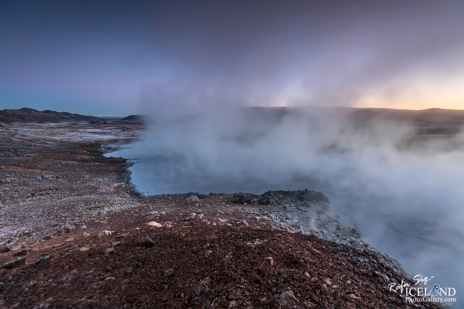
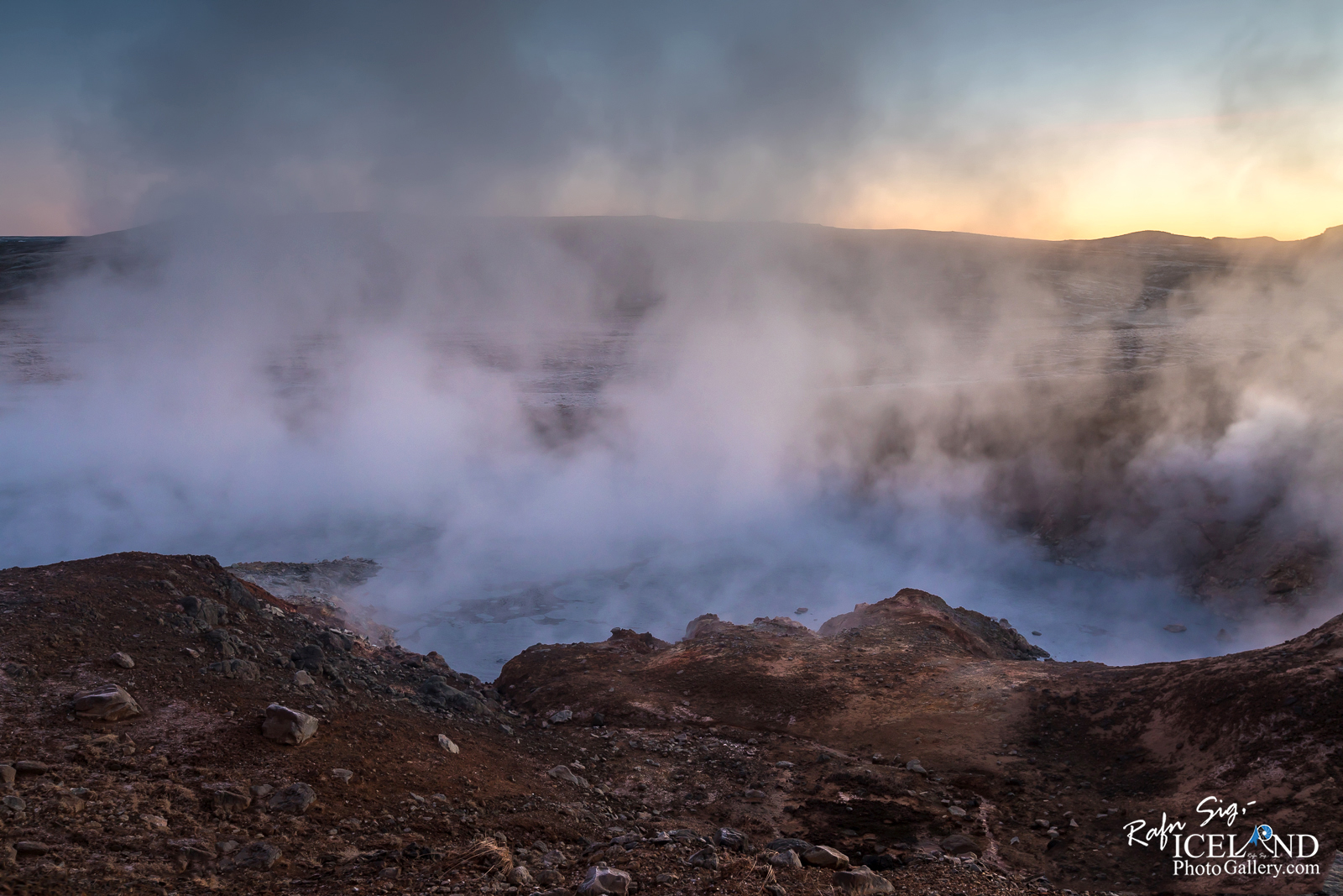
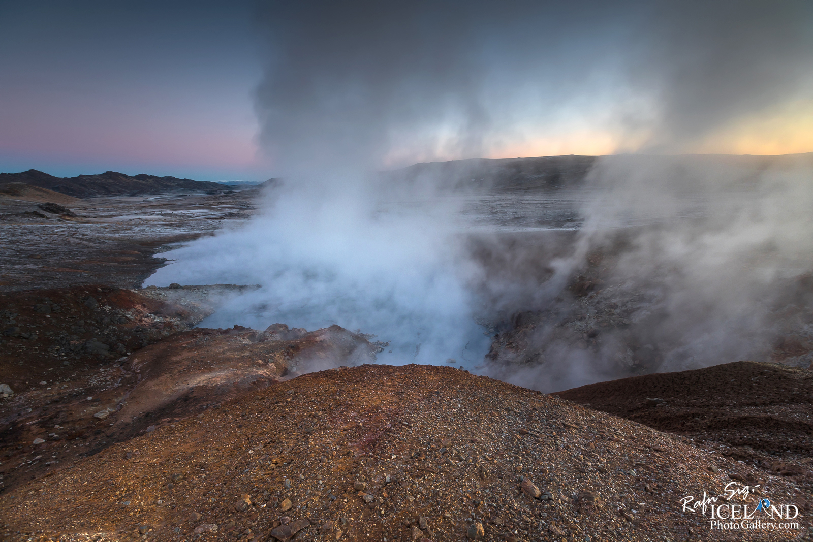
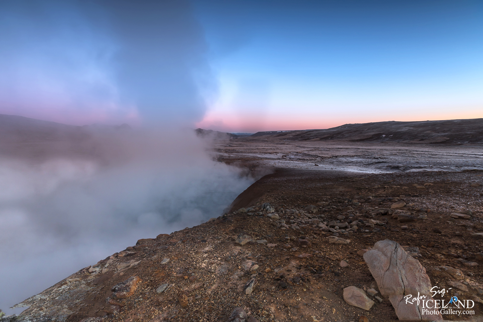
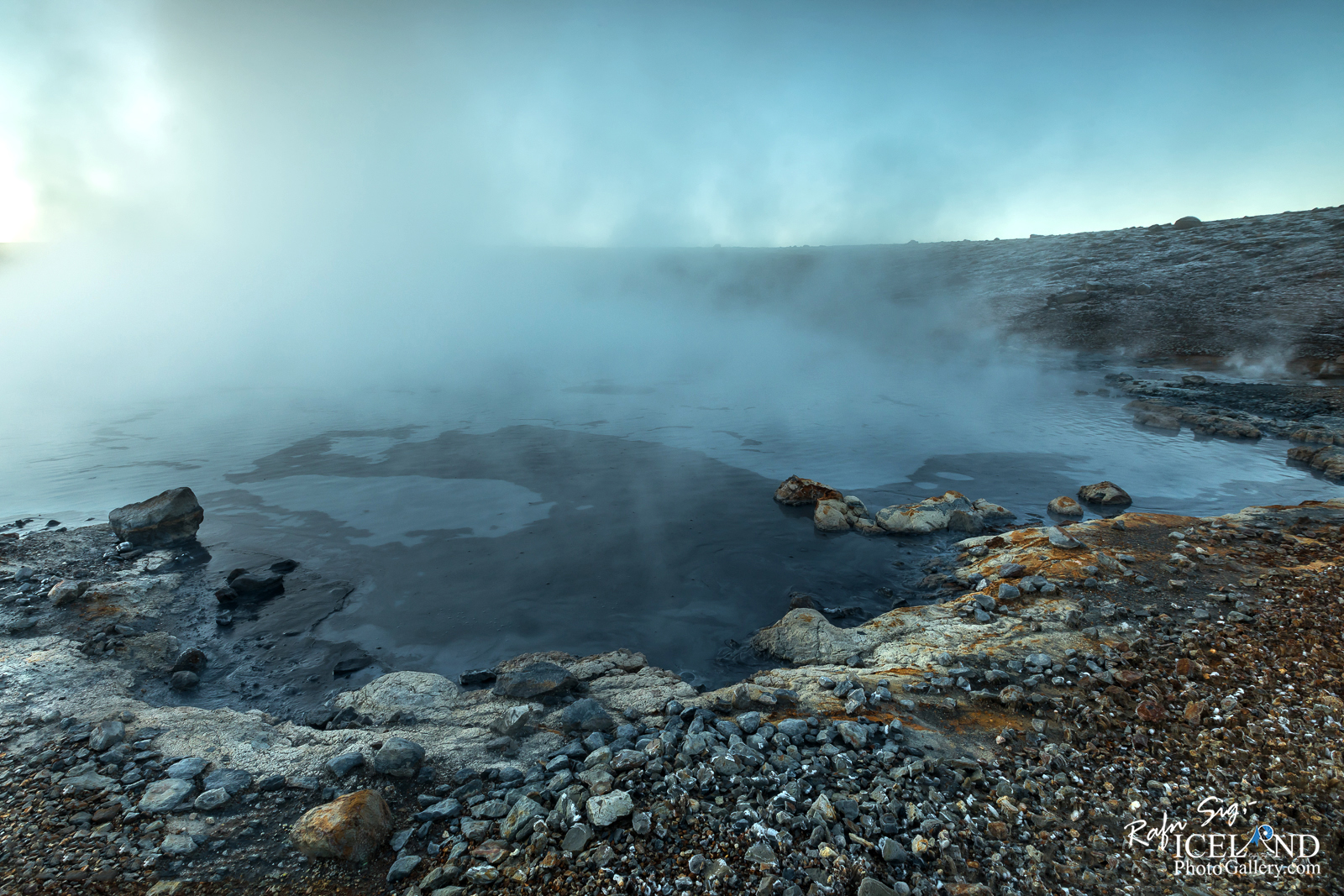
I waited for a while, or until I could see where I was walking so I could find the right place to photograph the sunrise. There was a small problem when I found the spot; the steam was in my way. The light breeze was in the wrong direction. Well, I didn’t panic because I know in Iceland, the wind is constantly changing so I hoped it would change for me this time, – and it did in the last minute.
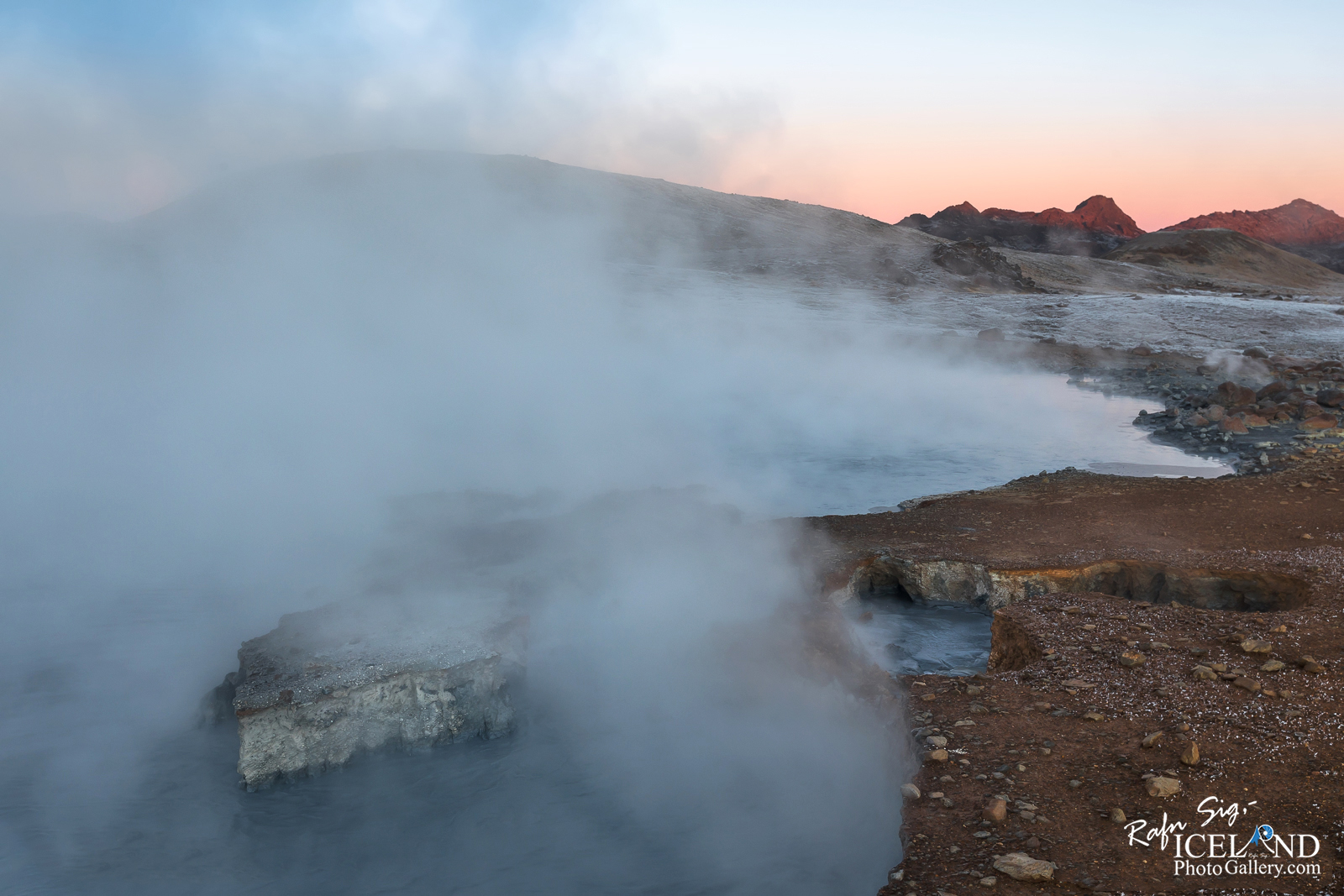
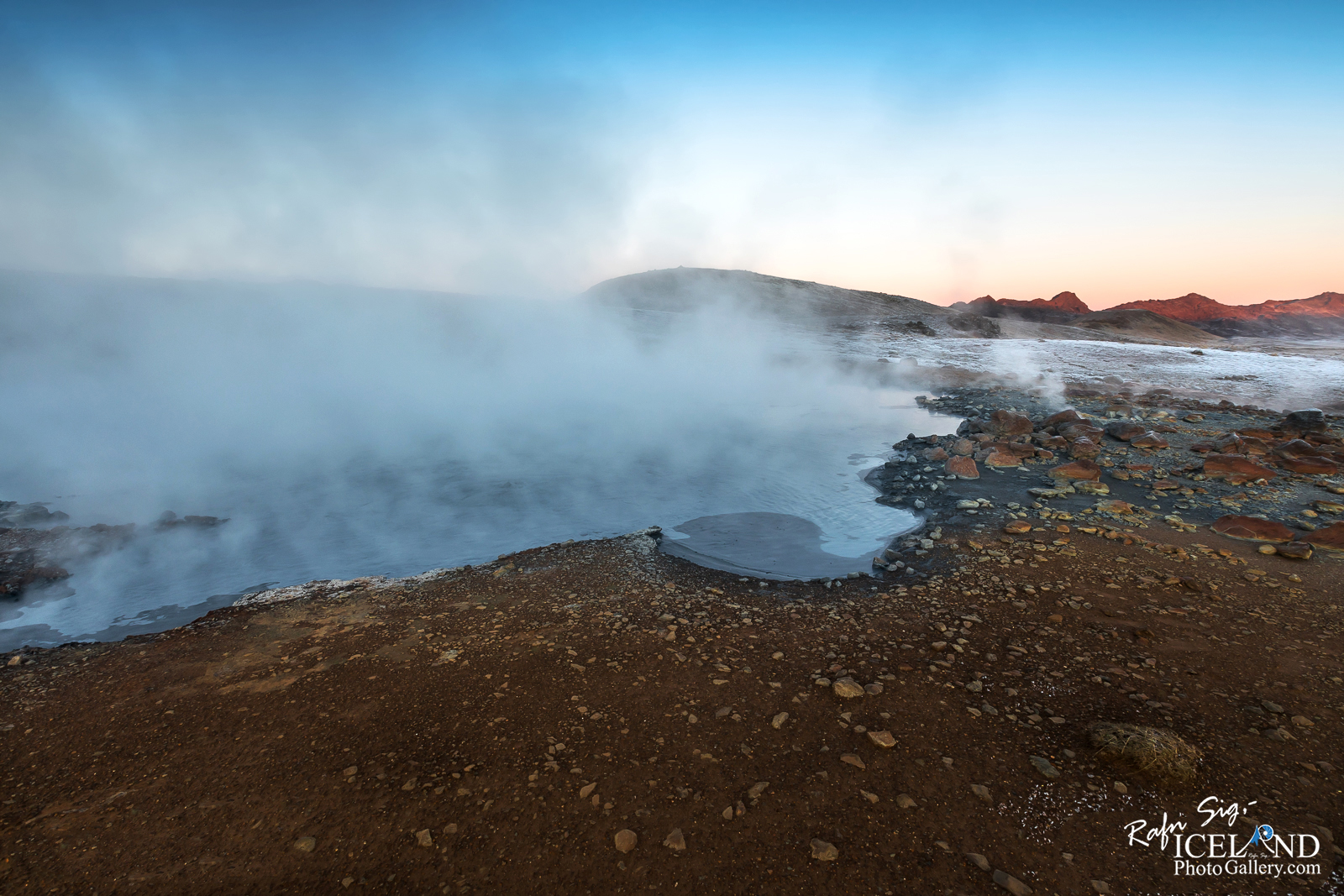
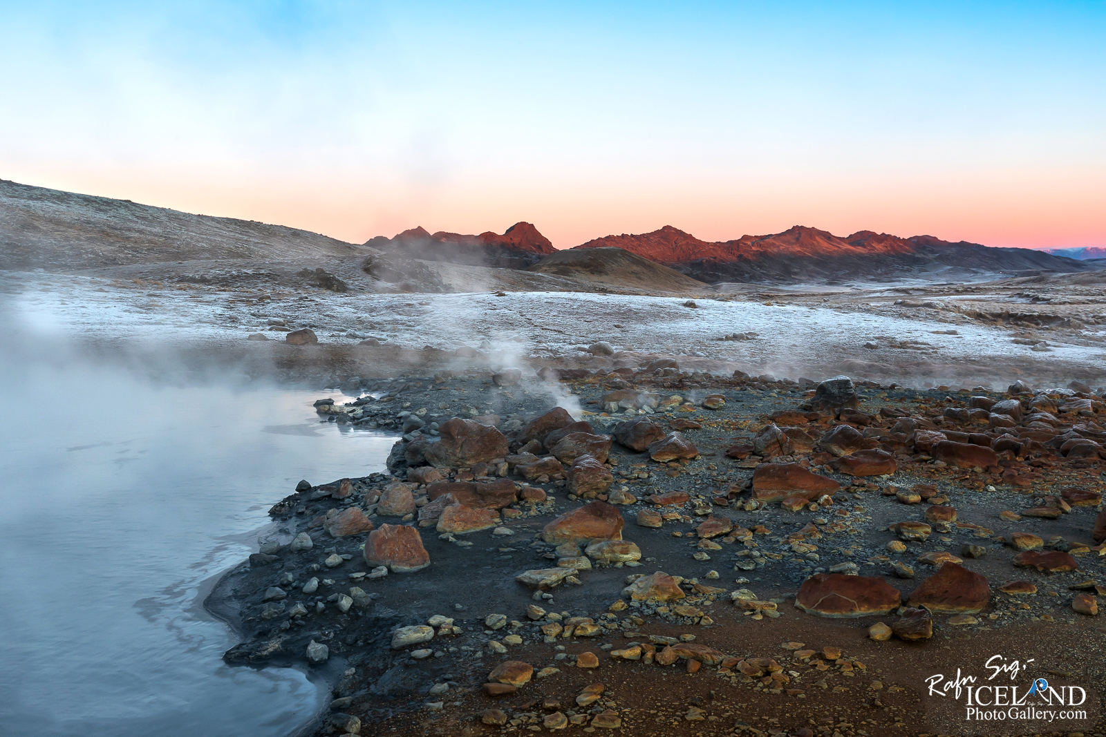
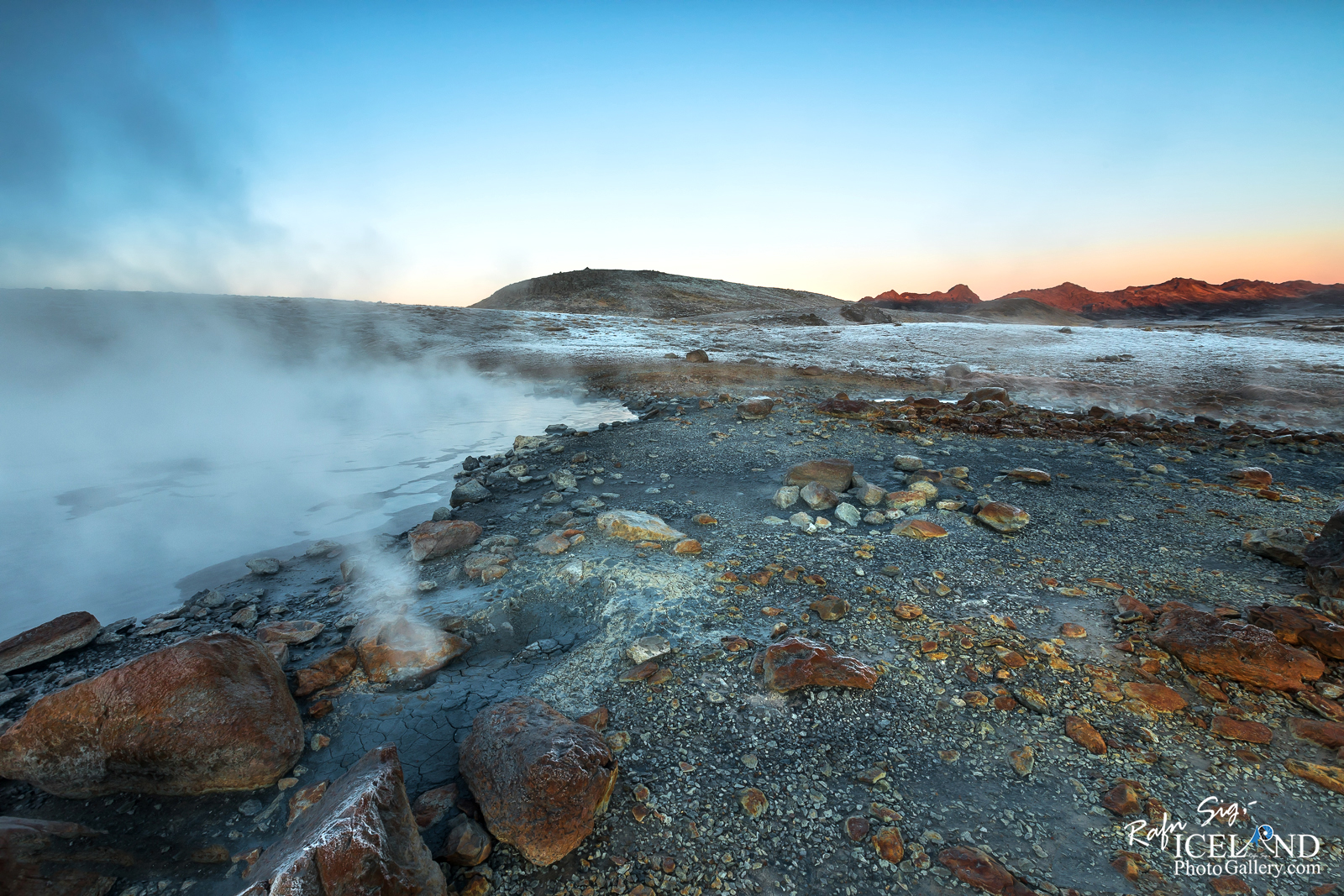
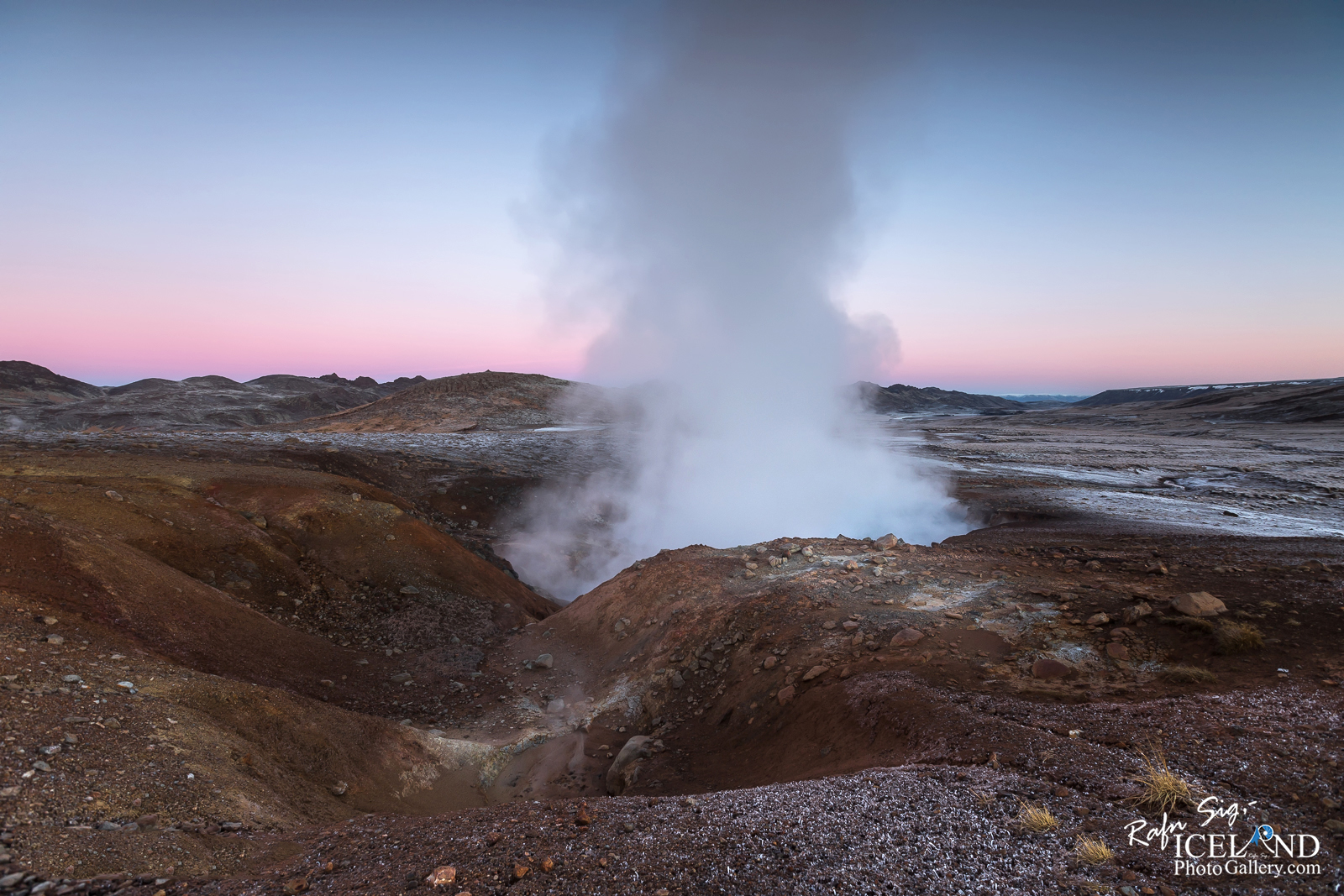
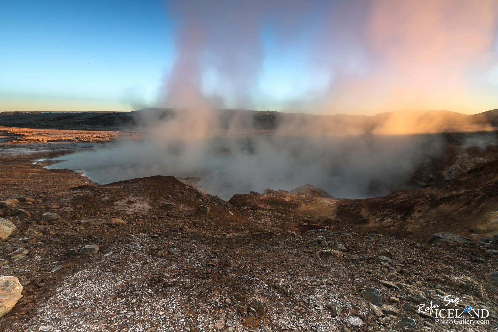
It was interesting to see all the light changes in the steam from the moment the Sun started to cast its first glimpse on it and then the whole area. Sometimes it looked like the steam reflected a little light beams on the soil here and there just to say “good morning my friend – welcome”. It’s incredible to see how wide the color spectrum is. On this day the sun does not reach the Geyser area itself, it will be later in January
I stayed there documenting Austurengjahver for almost five hours and the sun was starting to go down again when I reached the car.
It is vital to document this location as the Government has allowed the Geothermal Power plant company HS Orka to drill in this area and then they will destroy one of our most beautiful place on the Reykjanes Peninsula. The disruptions that would accompany the power project under consideration in the Austurengjar area would have an impact on the entire site and transform the appearance of Lake Kleifarvatn. The construction of a 50 MW electric power station is planned in the area. If plans for the 50 MW Austurengjar Power Plant are realized, a total of 10 to 15 boreholes would need to be drilled. We are trying our best to stop this action but it looks like we will not be able to do so (Money talks) . The strive will continue and we will use all the power we have to do so.
What is Austurengjahver?
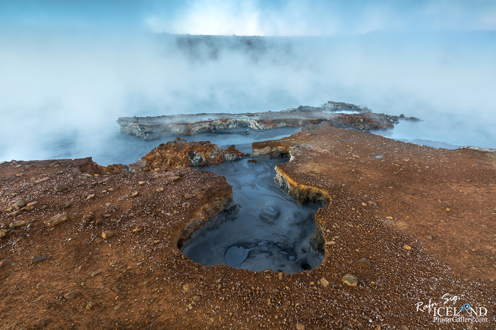
The geothermal area of Austurengjar extends from east of Lake Grænavatn to Lake Kleifarvatn in the north. Hot springs, mud pots, and fumaroles are scattered sparsely over the area. The largest and most powerful hot spring, called Austurengjahver, (also it has the name Engjahver or Stórihver) is located east of Lake Grænavatn.

The area grew very much larger after an earthquake in 1924 and I can see a lot of changes only over this one and a half year since I ’w been there.
The time I had on the 22nd of December 2018 was well spent.

Liked it?
Take a second to support me on Patreon

As a native photographer I feel responsible to leave all I can behind to show how it looked like, with my photography, before it’s too late.

Help Support This Blog
This blog is offered free of advertising and corporate sponsors, but needs your support. Making an income in art and writing is not easy or consistent. If you find these essays useful, please consider showing your appreciation by making a small donation.


2Hi there! Do you use Twitter? Id like to follow you if that would be ok. Im undoubtedly enjoying your Photos and blog and look forward to new posts.
I could not resist commenting. Exceptionally beautiful work