2023-04-04
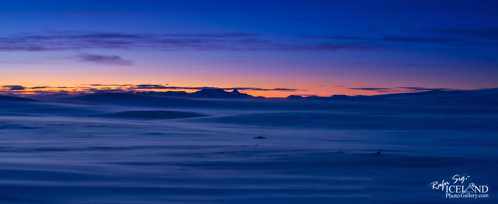
Sprengisandur in Winter Twilight │ Iceland Photo Gallery
Documenting Iceland
by: Rafn Sig,-
Sprengir er talinn vera suðvestan Fjórðungsvatns og vera staður, þar sem hestar sprungu Sveinagjáá reiðinni, þegar fólk reið eins hratt og það gat til að komast hjá því að hitta illar vættir, drauga eða álfa fyrir á leiðinni.
Eldra nafn á Sprengisandi er Gásasandur (í sumum fornritum aðeins nefndur Sandur), sem margir telja að hefjist norðan Háumýra, efsta gróðurlendis á Holtamannaafrétti.
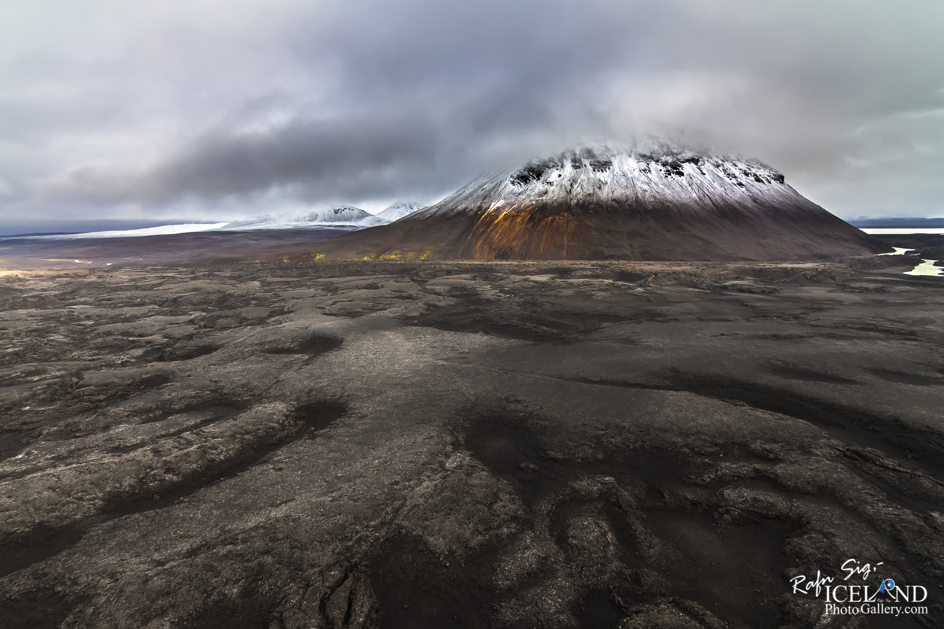
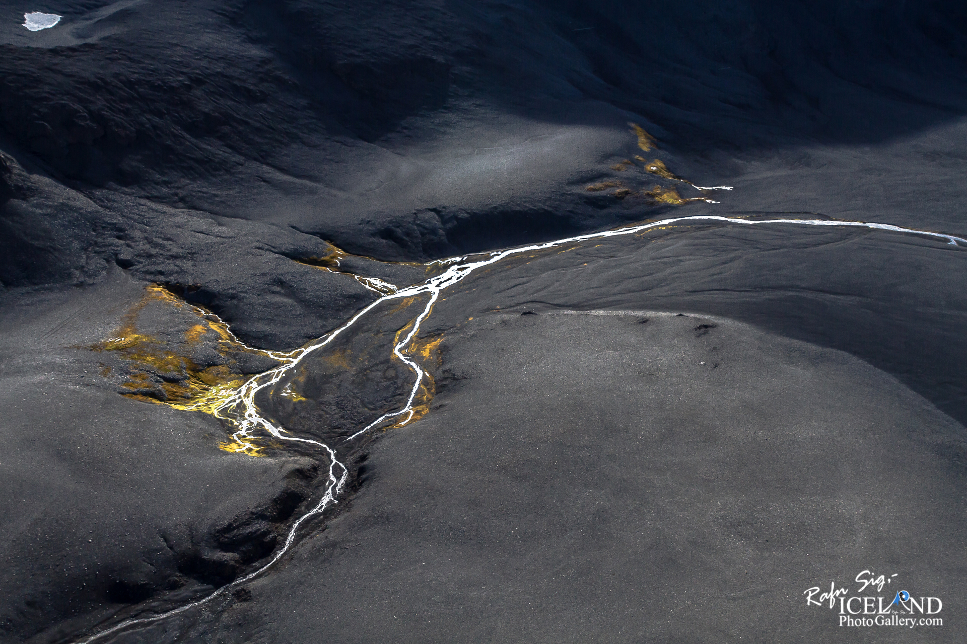
Sprengisandur er gróðursnauð og örfoka háslétta á miðhálendi Íslands. Suðurmörk Sprengisands miðast venjulega við Þjórsárver og norðanmörkin við Kiðagil, að austan teygir hann sig að rótum Tungnafellsjökuls og að Skjálfandafljóti, en að vestan að Þjórsá og þaðan norður með austurjaðri Hofsjökuls. Sprengisandur er ekki samfellt sandflæmi eða sandauðn þótt nafn hans gæti bent til þess.
Grýttur jökulruðningur þekur stór flæmi en áreyrar og sandar eru meðfram ám. Þar eru einnig hraun, Tunguhraun, sem þekur allstórt svæði norðan Tungnafellsjökuls. Fjórðungsalda er móbergsfell á miðjum Sprengisandi og vestan undir því er Fjórðungsvatn, stærsta stöðuvatnið á svæðinu. Um Sprengisand liggur Sprengisandsleið, forn fjallvegur sem tengir Norðurland og Suðurland. Allmikil umferð er um Sprengisand, einkum að sumarlagi. Ferðafélag Íslands reisti hús í Nýjadal við rætur Tungnafellsjökuls árið 1967 og þar er ágæt gistiaðstaða og tjaldstæði.
Hinn 15. ágúst 1933 var fyrst farið á bíl norður yfir Sprengisand. Ferðin tók sex daga að Myri í Báðardal
Sprengisandur is a highland plateau in Iceland, defined roughly as the area between the Hofsjökull and Vatnajökull glaciers.
Sprengisandur is an ancient pass – during the time of the Icelandic Free State (ca. 930–1265) it was one of the several important north-south routes that connected remote regions of the island to the Plains of the Parliament, Þingvellir, where the yearly parliament, Alþingi, was held each year at midsummer. In the sagas of Icelanders it is often called simply Sandr “Sand” or Sandleið, “Sand trail”. At its southern end, it was joined with another such route, Fjallabaksvegur nyrðri, running west from Landmannalaugar mountain hot springs area.
Sprengisandur is only accessible during summer – like other parts of the inner desert, it is impassable in winter because of the snow, and in spring because of floods. While being the shortest way to the Alþingi for some Icelanders, for example, those living around lake Ljósavatn that is very close to the northern end of the route, and for inhabitants of Vopnafjörður, it had the downside of having by far the longest stretch through the forbidding inner desert regions among the other possible routes.
For hundreds of kilometers, there was no fodder for horses to be had, and no human habitation to take shelter in. This feature gave the area its name: it is derived from Icelandic noun sandur “sand”, which denotes the volcanic ash deserts of the center of the island, and the verb sprengja that means “to ride a horse to death; to be on the point of bursting after running for too long”. One needed to ride as fast as possible, nearly driving the horses to death, to cross the mountain desert and reach the inhabited regions of the island again before one ran out of victuals.
. . . All info at: https://www.patreon.com/RafnSig


– 0 –
Liked it?
Take a second to support me on Patreon

Viltu styrkja þessa síðu?
Vefsíðan Iceland Photo Gallery er unnin í sjálfboðavinnu. Ef þú hefur áhuga á að styrkja þetta framtak til áframhaldandi uppbyggingar er hægt að leggja inn á:
Reikningsnr.: 0101-26-013169
Kennitala: 310155-4469